You are here: Home > Network List > TJ - Tajikistan National Seismic Network Stations List
> Station GARM Garm, Tajikistan > Earthquake Result Viewer
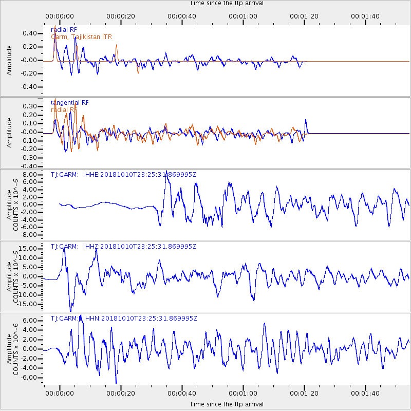
GARM Garm, Tajikistan - Earthquake Result Viewer
*The percent match for this event was below the threshold and hence no stack was calculated.
| Earthquake location: |
Kuril Islands |
| Earthquake latitude/longitude: |
49.1/156.4 |
| Earthquake time(UTC): |
2018/10/10 (283) 23:16:04 GMT |
| Earthquake Depth: |
33 km |
| Earthquake Magnitude: |
6.8 Mi |
| Earthquake Catalog/Contributor: |
NEIC PDE/at |
|
| Network: |
TJ Tajikistan National Seismic Network |
| Station: |
GARM Garm, Tajikistan |
| Lat/Lon: |
39.00 N/70.32 E |
| Elevation: |
1305 m |
|
| Distance: |
59.5 deg |
| Az: |
295.562 deg |
| Baz: |
49.546 deg |
| Ray Param: |
$rayparam |
*The percent match for this event was below the threshold and hence was not used in the summary stack. |
|
| Radial Match: |
89.08294 % |
| Radial Bump: |
400 |
| Transverse Match: |
81.86421 % |
| Transverse Bump: |
400 |
| SOD ConfigId: |
13570011 |
| Insert Time: |
2019-05-01 11:51:56.411 +0000 |
| GWidth: |
2.5 |
| Max Bumps: |
400 |
| Tol: |
0.001 |
|
Signal To Noise
| Channel | StoN | STA | LTA |
| TJ:GARM: :HHZ:20181010T23:25:31.869995Z | 15.065672 | 1.03589655E-5 | 6.875874E-7 |
| TJ:GARM: :HHN:20181010T23:25:31.869995Z | 5.208973 | 1.7606628E-6 | 3.3800575E-7 |
| TJ:GARM: :HHE:20181010T23:25:31.869995Z | 8.374798 | 4.490884E-6 | 5.362379E-7 |
| Arrivals |
| Ps | |
| PpPs | |
| PsPs/PpSs | |


