You are here: Home > Network List > TA - USArray Transportable Network (new EarthScope stations) Stations List
> Station I14A Mackay, ID, USA > Earthquake Result Viewer
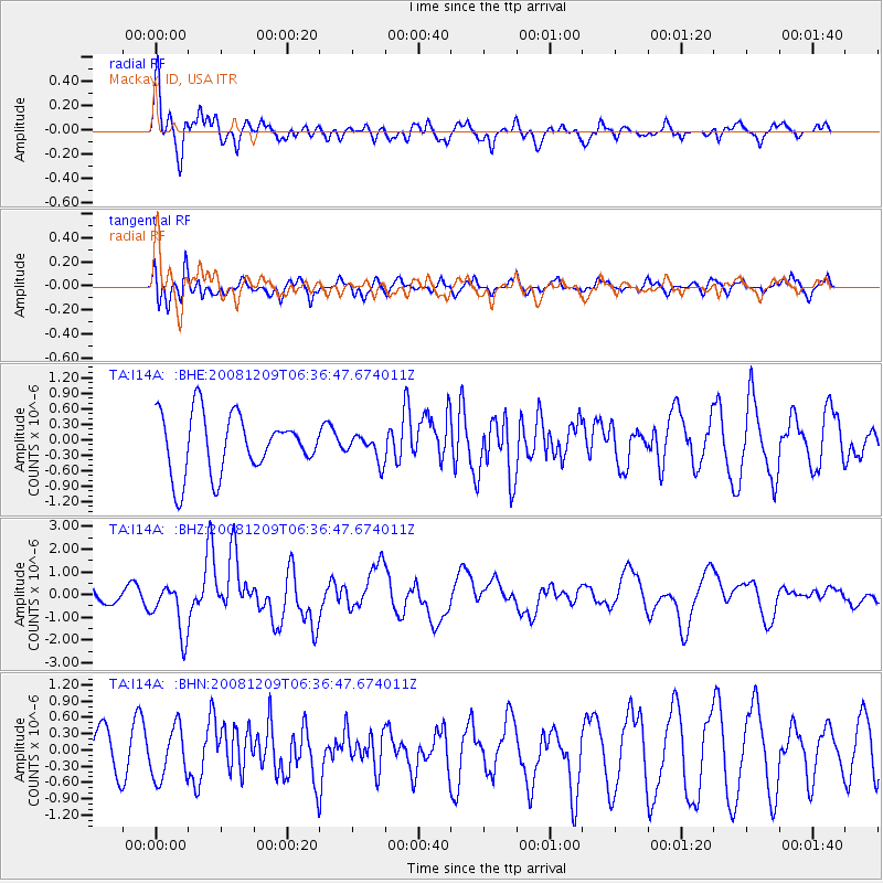
I14A Mackay, ID, USA - Earthquake Result Viewer
*The percent match for this event was below the threshold and hence no stack was calculated.
| Earthquake location: |
Kermadec Islands Region |
| Earthquake latitude/longitude: |
-31.2/-176.9 |
| Earthquake time(UTC): |
2008/12/09 (344) 06:23:59 GMT |
| Earthquake Depth: |
18 km |
| Earthquake Magnitude: |
6.2 MB, 6.7 MS, 6.8 MW, 6.7 MW |
| Earthquake Catalog/Contributor: |
WHDF/NEIC |
|
| Network: |
TA USArray Transportable Network (new EarthScope stations) |
| Station: |
I14A Mackay, ID, USA |
| Lat/Lon: |
43.93 N/113.45 W |
| Elevation: |
1897 m |
|
| Distance: |
94.6 deg |
| Az: |
40.433 deg |
| Baz: |
230.256 deg |
| Ray Param: |
$rayparam |
*The percent match for this event was below the threshold and hence was not used in the summary stack. |
|
| Radial Match: |
61.15737 % |
| Radial Bump: |
400 |
| Transverse Match: |
65.02336 % |
| Transverse Bump: |
400 |
| SOD ConfigId: |
2658 |
| Insert Time: |
2010-03-06 16:45:33.405 +0000 |
| GWidth: |
2.5 |
| Max Bumps: |
400 |
| Tol: |
0.001 |
|
Signal To Noise
| Channel | StoN | STA | LTA |
| TA:I14A: :BHZ:20081209T06:36:47.674011Z | 2.069065 | 1.1462487E-6 | 5.539935E-7 |
| TA:I14A: :BHN:20081209T06:36:47.674011Z | 0.69074494 | 4.747111E-7 | 6.872451E-7 |
| TA:I14A: :BHE:20081209T06:36:47.674011Z | 0.43919578 | 2.4981117E-7 | 5.6879225E-7 |
| Arrivals |
| Ps | |
| PpPs | |
| PsPs/PpSs | |


