You are here: Home > Network List > AV - Alaska Volcano Observatory Stations List
> Station SPCR Ckakachatna River, Mount Spurr, Alaska > Earthquake Result Viewer
SPCR Ckakachatna River, Mount Spurr, Alaska - Earthquake Result Viewer
*The percent match for this event was below the threshold and hence no stack was calculated.
| Earthquake location: |
Kuril Islands |
| Earthquake latitude/longitude: |
49.2/156.3 |
| Earthquake time(UTC): |
2018/10/10 (283) 23:21:50 GMT |
| Earthquake Depth: |
10 km |
| Earthquake Magnitude: |
5.5 mb |
| Earthquake Catalog/Contributor: |
NEIC PDE/us |
|
| Network: |
AV Alaska Volcano Observatory |
| Station: |
SPCR Ckakachatna River, Mount Spurr, Alaska |
| Lat/Lon: |
61.20 N/152.21 W |
| Elevation: |
984 m |
|
| Distance: |
30.9 deg |
| Az: |
47.573 deg |
| Baz: |
270.93 deg |
| Ray Param: |
$rayparam |
*The percent match for this event was below the threshold and hence was not used in the summary stack. |
|
| Radial Match: |
66.743805 % |
| Radial Bump: |
400 |
| Transverse Match: |
48.003742 % |
| Transverse Bump: |
289 |
| SOD ConfigId: |
13570011 |
| Insert Time: |
2019-05-01 11:55:30.611 +0000 |
| GWidth: |
2.5 |
| Max Bumps: |
400 |
| Tol: |
0.001 |
|
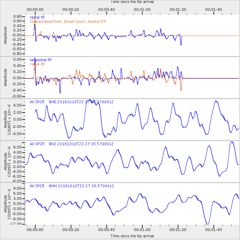
Signal To Noise
| Channel | StoN | STA | LTA |
| AV:SPCR: :BHZ:20181010T23:27:36.579991Z | 1.2603447 | 3.2569076E-6 | 2.5841402E-6 |
| AV:SPCR: :BHN:20181010T23:27:36.579991Z | 0.55076796 | 1.9340987E-6 | 3.5116398E-6 |
| AV:SPCR: :BHE:20181010T23:27:36.579991Z | 2.450474 | 5.559559E-6 | 2.2687689E-6 |
| Arrivals |
| Ps | |
| PpPs | |
| PsPs/PpSs | |


