You are here: Home > Network List > CN - Canadian National Seismograph Network Stations List
> Station INK INUVIK, NT > Earthquake Result Viewer
INK INUVIK, NT - Earthquake Result Viewer
*The percent match for this event was below the threshold and hence no stack was calculated.
| Earthquake location: |
Kuril Islands |
| Earthquake latitude/longitude: |
49.2/156.3 |
| Earthquake time(UTC): |
2018/10/10 (283) 23:21:50 GMT |
| Earthquake Depth: |
10 km |
| Earthquake Magnitude: |
5.5 mb |
| Earthquake Catalog/Contributor: |
NEIC PDE/us |
|
| Network: |
CN Canadian National Seismograph Network |
| Station: |
INK INUVIK, NT |
| Lat/Lon: |
68.31 N/133.53 W |
| Elevation: |
44 m |
|
| Distance: |
38.4 deg |
| Az: |
34.246 deg |
| Baz: |
276.867 deg |
| Ray Param: |
$rayparam |
*The percent match for this event was below the threshold and hence was not used in the summary stack. |
|
| Radial Match: |
54.249577 % |
| Radial Bump: |
400 |
| Transverse Match: |
56.98449 % |
| Transverse Bump: |
342 |
| SOD ConfigId: |
13570011 |
| Insert Time: |
2019-05-01 11:56:38.959 +0000 |
| GWidth: |
2.5 |
| Max Bumps: |
400 |
| Tol: |
0.001 |
|
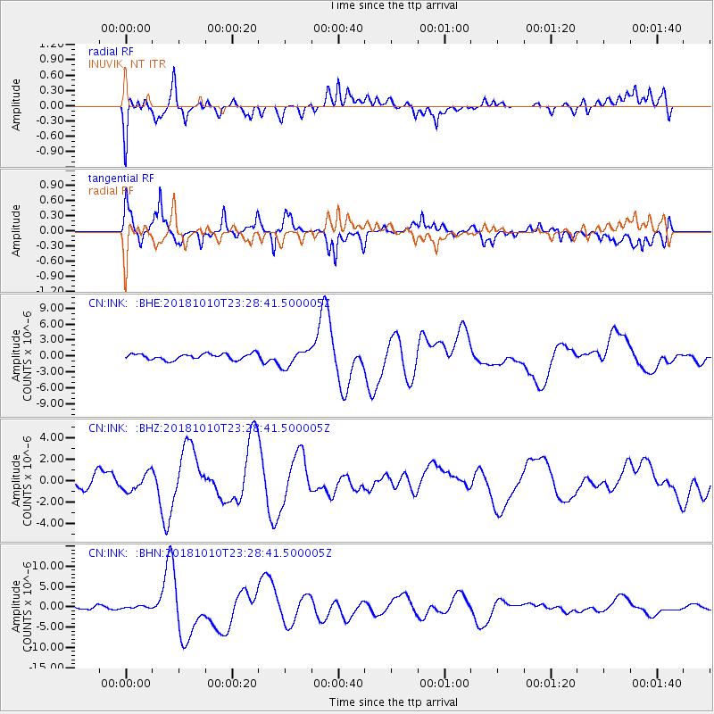
Signal To Noise
| Channel | StoN | STA | LTA |
| CN:INK: :BHZ:20181010T23:28:41.500005Z | 1.0890613 | 8.0101233E-7 | 7.355071E-7 |
| CN:INK: :BHN:20181010T23:28:41.500005Z | 0.8301543 | 3.1020937E-7 | 3.7367676E-7 |
| CN:INK: :BHE:20181010T23:28:41.500005Z | 2.851037 | 1.5953738E-6 | 5.595767E-7 |
| Arrivals |
| Ps | |
| PpPs | |
| PsPs/PpSs | |


