You are here: Home > Network List > TA - USArray Transportable Network (new EarthScope stations) Stations List
> Station I14A Mackay, ID, USA > Earthquake Result Viewer
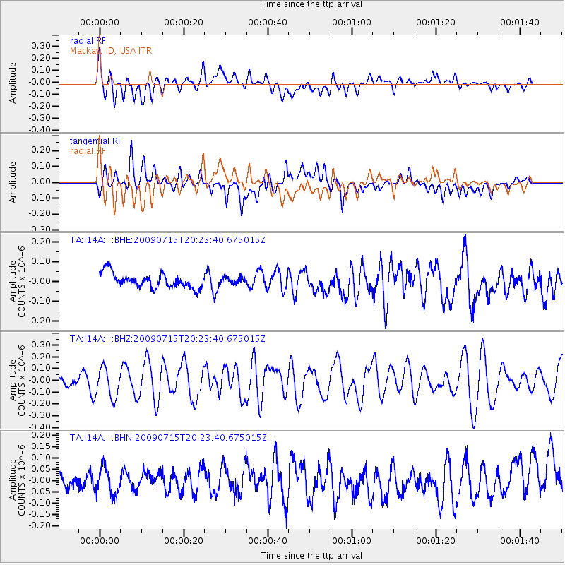
I14A Mackay, ID, USA - Earthquake Result Viewer
*The percent match for this event was below the threshold and hence no stack was calculated.
| Earthquake location: |
New Ireland Region, P.N.G. |
| Earthquake latitude/longitude: |
-3.4/150.5 |
| Earthquake time(UTC): |
2009/07/15 (196) 20:10:42 GMT |
| Earthquake Depth: |
13 km |
| Earthquake Magnitude: |
5.6 MB, 6.1 MS, 6.1 MW, 6.1 MW |
| Earthquake Catalog/Contributor: |
WHDF/NEIC |
|
| Network: |
TA USArray Transportable Network (new EarthScope stations) |
| Station: |
I14A Mackay, ID, USA |
| Lat/Lon: |
43.93 N/113.45 W |
| Elevation: |
1897 m |
|
| Distance: |
96.7 deg |
| Az: |
46.338 deg |
| Baz: |
271.754 deg |
| Ray Param: |
$rayparam |
*The percent match for this event was below the threshold and hence was not used in the summary stack. |
|
| Radial Match: |
61.310707 % |
| Radial Bump: |
400 |
| Transverse Match: |
57.379887 % |
| Transverse Bump: |
400 |
| SOD ConfigId: |
2648 |
| Insert Time: |
2010-03-06 16:45:52.422 +0000 |
| GWidth: |
2.5 |
| Max Bumps: |
400 |
| Tol: |
0.001 |
|
Signal To Noise
| Channel | StoN | STA | LTA |
| TA:I14A: :BHZ:20090715T20:23:40.675015Z | 2.6020975 | 1.2440223E-7 | 4.780844E-8 |
| TA:I14A: :BHN:20090715T20:23:40.675015Z | 1.1609449 | 6.073376E-8 | 5.2314075E-8 |
| TA:I14A: :BHE:20090715T20:23:40.675015Z | 0.4602988 | 1.6745847E-8 | 3.638038E-8 |
| Arrivals |
| Ps | |
| PpPs | |
| PsPs/PpSs | |


