You are here: Home > Network List > TA - USArray Transportable Network (new EarthScope stations) Stations List
> Station D25K Kavik River, AK, USA > Earthquake Result Viewer
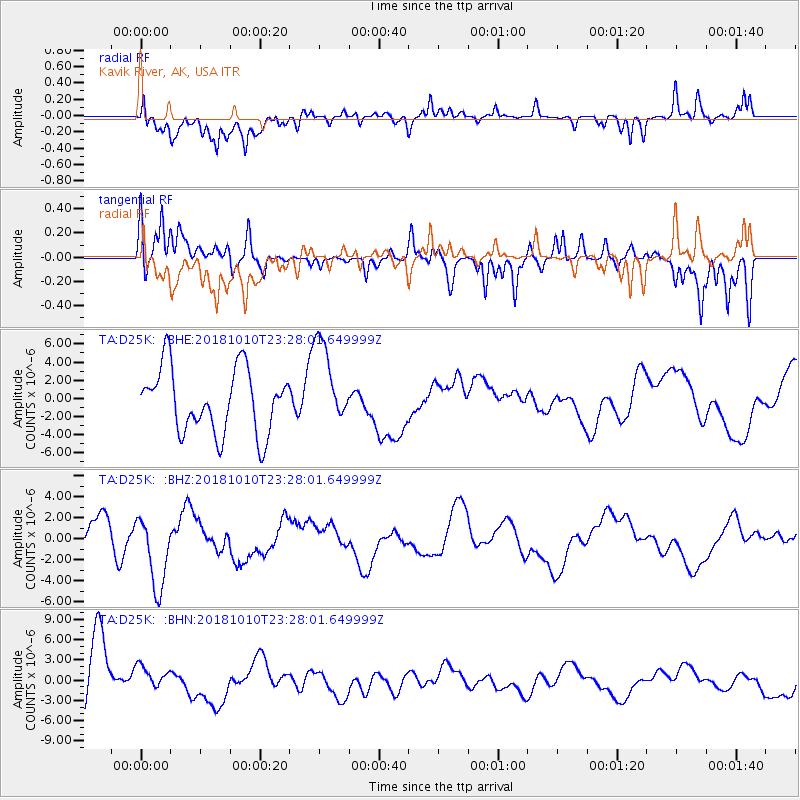
D25K Kavik River, AK, USA - Earthquake Result Viewer
*The percent match for this event was below the threshold and hence no stack was calculated.
| Earthquake location: |
Kuril Islands |
| Earthquake latitude/longitude: |
49.2/156.3 |
| Earthquake time(UTC): |
2018/10/10 (283) 23:21:50 GMT |
| Earthquake Depth: |
10 km |
| Earthquake Magnitude: |
5.5 mb |
| Earthquake Catalog/Contributor: |
NEIC PDE/us |
|
| Network: |
TA USArray Transportable Network (new EarthScope stations) |
| Station: |
D25K Kavik River, AK, USA |
| Lat/Lon: |
69.32 N/146.38 W |
| Elevation: |
770 m |
|
| Distance: |
33.8 deg |
| Az: |
32.551 deg |
| Baz: |
263.518 deg |
| Ray Param: |
$rayparam |
*The percent match for this event was below the threshold and hence was not used in the summary stack. |
|
| Radial Match: |
39.599083 % |
| Radial Bump: |
400 |
| Transverse Match: |
42.855225 % |
| Transverse Bump: |
323 |
| SOD ConfigId: |
13570011 |
| Insert Time: |
2019-05-01 12:00:24.869 +0000 |
| GWidth: |
2.5 |
| Max Bumps: |
400 |
| Tol: |
0.001 |
|
Signal To Noise
| Channel | StoN | STA | LTA |
| TA:D25K: :BHZ:20181010T23:28:01.649999Z | 1.9814166 | 3.4790828E-6 | 1.7558564E-6 |
| TA:D25K: :BHN:20181010T23:28:01.649999Z | 0.3049209 | 1.6582276E-6 | 5.4382217E-6 |
| TA:D25K: :BHE:20181010T23:28:01.649999Z | 1.3299661 | 4.7049575E-6 | 3.5376522E-6 |
| Arrivals |
| Ps | |
| PpPs | |
| PsPs/PpSs | |


