You are here: Home > Network List > TA - USArray Transportable Network (new EarthScope stations) Stations List
> Station I30M Mount Dempster, Yukon, CAN > Earthquake Result Viewer
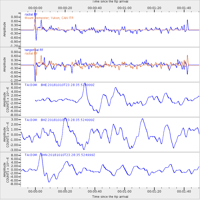
I30M Mount Dempster, Yukon, CAN - Earthquake Result Viewer
*The percent match for this event was below the threshold and hence no stack was calculated.
| Earthquake location: |
Kuril Islands |
| Earthquake latitude/longitude: |
49.2/156.3 |
| Earthquake time(UTC): |
2018/10/10 (283) 23:21:50 GMT |
| Earthquake Depth: |
10 km |
| Earthquake Magnitude: |
5.5 mb |
| Earthquake Catalog/Contributor: |
NEIC PDE/us |
|
| Network: |
TA USArray Transportable Network (new EarthScope stations) |
| Station: |
I30M Mount Dempster, Yukon, CAN |
| Lat/Lon: |
65.22 N/136.38 W |
| Elevation: |
1399 m |
|
| Distance: |
37.7 deg |
| Az: |
39.468 deg |
| Baz: |
278.36 deg |
| Ray Param: |
$rayparam |
*The percent match for this event was below the threshold and hence was not used in the summary stack. |
|
| Radial Match: |
43.02939 % |
| Radial Bump: |
400 |
| Transverse Match: |
51.798893 % |
| Transverse Bump: |
400 |
| SOD ConfigId: |
13570011 |
| Insert Time: |
2019-05-01 12:00:43.807 +0000 |
| GWidth: |
2.5 |
| Max Bumps: |
400 |
| Tol: |
0.001 |
|
Signal To Noise
| Channel | StoN | STA | LTA |
| TA:I30M: :BHZ:20181010T23:28:35.524999Z | 0.5603442 | 5.0318846E-7 | 8.979988E-7 |
| TA:I30M: :BHN:20181010T23:28:35.524999Z | 10.146827 | 5.28694E-6 | 5.2104366E-7 |
| TA:I30M: :BHE:20181010T23:28:35.524999Z | 10.207725 | 4.728967E-6 | 4.6327332E-7 |
| Arrivals |
| Ps | |
| PpPs | |
| PsPs/PpSs | |


