You are here: Home > Network List > TA - USArray Transportable Network (new EarthScope stations) Stations List
> Station F26K Sheenjek River, AK, USA > Earthquake Result Viewer
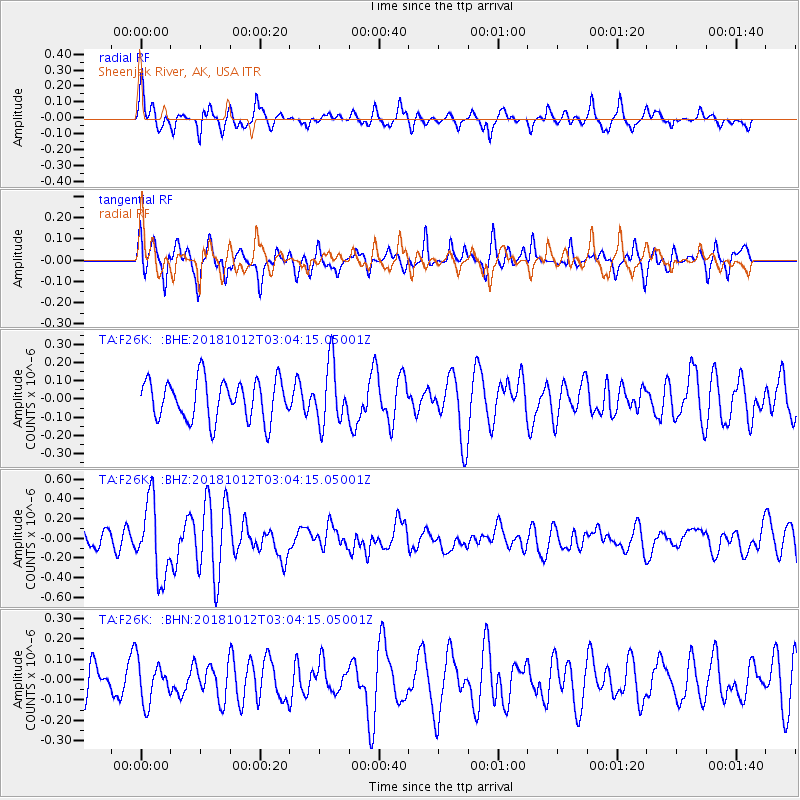
F26K Sheenjek River, AK, USA - Earthquake Result Viewer
*The percent match for this event was below the threshold and hence no stack was calculated.
| Earthquake location: |
New Britain Region, P.N.G. |
| Earthquake latitude/longitude: |
-6.3/151.1 |
| Earthquake time(UTC): |
2018/10/12 (285) 02:52:07 GMT |
| Earthquake Depth: |
35 km |
| Earthquake Magnitude: |
5.7 Mww |
| Earthquake Catalog/Contributor: |
NEIC PDE/us |
|
| Network: |
TA USArray Transportable Network (new EarthScope stations) |
| Station: |
F26K Sheenjek River, AK, USA |
| Lat/Lon: |
67.69 N/144.15 W |
| Elevation: |
683 m |
|
| Distance: |
86.5 deg |
| Az: |
20.244 deg |
| Baz: |
244.299 deg |
| Ray Param: |
$rayparam |
*The percent match for this event was below the threshold and hence was not used in the summary stack. |
|
| Radial Match: |
49.387325 % |
| Radial Bump: |
354 |
| Transverse Match: |
68.18202 % |
| Transverse Bump: |
400 |
| SOD ConfigId: |
13570011 |
| Insert Time: |
2019-05-01 12:11:34.708 +0000 |
| GWidth: |
2.5 |
| Max Bumps: |
400 |
| Tol: |
0.001 |
|
Signal To Noise
| Channel | StoN | STA | LTA |
| TA:F26K: :BHZ:20181012T03:04:15.05001Z | 3.3435068 | 3.7980902E-7 | 1.1359601E-7 |
| TA:F26K: :BHN:20181012T03:04:15.05001Z | 1.0632228 | 9.9669904E-8 | 9.37432E-8 |
| TA:F26K: :BHE:20181012T03:04:15.05001Z | 1.488548 | 1.6289202E-7 | 1.0943014E-7 |
| Arrivals |
| Ps | |
| PpPs | |
| PsPs/PpSs | |


