You are here: Home > Network List > CI - Caltech Regional Seismic Network Stations List
> Station MPM Manuel Prospect Mine, California, USA > Earthquake Result Viewer
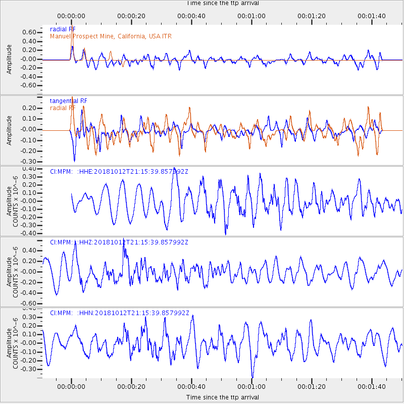
MPM Manuel Prospect Mine, California, USA - Earthquake Result Viewer
*The percent match for this event was below the threshold and hence no stack was calculated.
| Earthquake location: |
Guatemala |
| Earthquake latitude/longitude: |
14.2/-91.2 |
| Earthquake time(UTC): |
2018/10/12 (285) 21:09:49 GMT |
| Earthquake Depth: |
67 km |
| Earthquake Magnitude: |
5.6 Mww |
| Earthquake Catalog/Contributor: |
NEIC PDE/us |
|
| Network: |
CI Caltech Regional Seismic Network |
| Station: |
MPM Manuel Prospect Mine, California, USA |
| Lat/Lon: |
36.06 N/117.49 W |
| Elevation: |
185 m |
|
| Distance: |
32.1 deg |
| Az: |
317.506 deg |
| Baz: |
126.044 deg |
| Ray Param: |
$rayparam |
*The percent match for this event was below the threshold and hence was not used in the summary stack. |
|
| Radial Match: |
54.460293 % |
| Radial Bump: |
400 |
| Transverse Match: |
56.75838 % |
| Transverse Bump: |
400 |
| SOD ConfigId: |
13570011 |
| Insert Time: |
2019-05-01 12:16:17.709 +0000 |
| GWidth: |
2.5 |
| Max Bumps: |
400 |
| Tol: |
0.001 |
|
Signal To Noise
| Channel | StoN | STA | LTA |
| CI:MPM: :HHZ:20181012T21:15:39.857992Z | 1.776442 | 2.8319315E-7 | 1.5941593E-7 |
| CI:MPM: :HHN:20181012T21:15:39.857992Z | 0.80233955 | 1.1593719E-7 | 1.4449891E-7 |
| CI:MPM: :HHE:20181012T21:15:39.857992Z | 1.5455251 | 2.2778353E-7 | 1.4738261E-7 |
| Arrivals |
| Ps | |
| PpPs | |
| PsPs/PpSs | |


