You are here: Home > Network List > TA - USArray Transportable Network (new EarthScope stations) Stations List
> Station J25K Salcha River, AK, USA > Earthquake Result Viewer
J25K Salcha River, AK, USA - Earthquake Result Viewer
*The percent match for this event was below the threshold and hence no stack was calculated.
| Earthquake location: |
Guatemala |
| Earthquake latitude/longitude: |
14.2/-91.2 |
| Earthquake time(UTC): |
2018/10/12 (285) 21:09:49 GMT |
| Earthquake Depth: |
67 km |
| Earthquake Magnitude: |
5.6 Mww |
| Earthquake Catalog/Contributor: |
NEIC PDE/us |
|
| Network: |
TA USArray Transportable Network (new EarthScope stations) |
| Station: |
J25K Salcha River, AK, USA |
| Lat/Lon: |
64.61 N/145.37 W |
| Elevation: |
949 m |
|
| Distance: |
62.3 deg |
| Az: |
336.76 deg |
| Baz: |
117.407 deg |
| Ray Param: |
$rayparam |
*The percent match for this event was below the threshold and hence was not used in the summary stack. |
|
| Radial Match: |
67.062836 % |
| Radial Bump: |
400 |
| Transverse Match: |
48.87855 % |
| Transverse Bump: |
400 |
| SOD ConfigId: |
13570011 |
| Insert Time: |
2019-05-01 12:19:37.415 +0000 |
| GWidth: |
2.5 |
| Max Bumps: |
400 |
| Tol: |
0.001 |
|
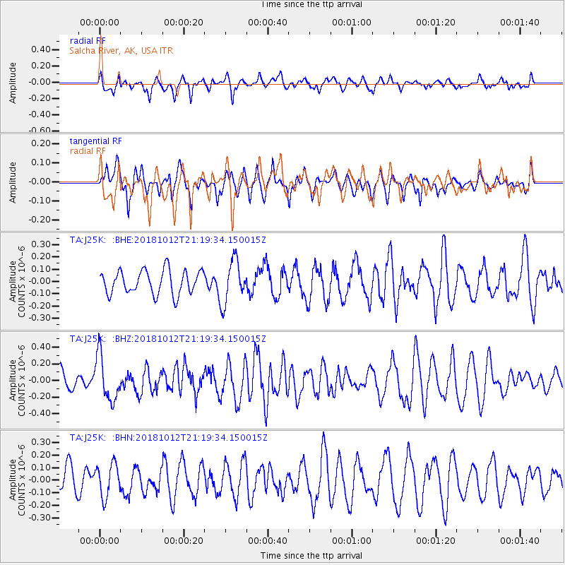
Signal To Noise
| Channel | StoN | STA | LTA |
| TA:J25K: :BHZ:20181012T21:19:34.150015Z | 2.30236 | 2.8230207E-7 | 1.2261421E-7 |
| TA:J25K: :BHN:20181012T21:19:34.150015Z | 1.171055 | 1.3330043E-7 | 1.1382935E-7 |
| TA:J25K: :BHE:20181012T21:19:34.150015Z | 1.8452786 | 1.7897413E-7 | 9.69903E-8 |
| Arrivals |
| Ps | |
| PpPs | |
| PsPs/PpSs | |


