You are here: Home > Network List > TA - USArray Transportable Network (new EarthScope stations) Stations List
> Station H15A Lima, MT, USA > Earthquake Result Viewer
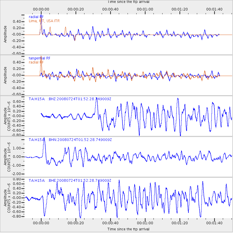
H15A Lima, MT, USA - Earthquake Result Viewer
*The percent match for this event was below the threshold and hence no stack was calculated.
| Earthquake location: |
Kuril Islands |
| Earthquake latitude/longitude: |
51.0/157.6 |
| Earthquake time(UTC): |
2008/07/24 (206) 01:43:16 GMT |
| Earthquake Depth: |
27 km |
| Earthquake Magnitude: |
6.0 MB, 6.0 MS, 6.2 MW, 6.2 MW |
| Earthquake Catalog/Contributor: |
WHDF/NEIC |
|
| Network: |
TA USArray Transportable Network (new EarthScope stations) |
| Station: |
H15A Lima, MT, USA |
| Lat/Lon: |
44.62 N/112.64 W |
| Elevation: |
1957 m |
|
| Distance: |
57.0 deg |
| Az: |
58.339 deg |
| Baz: |
311.095 deg |
| Ray Param: |
$rayparam |
*The percent match for this event was below the threshold and hence was not used in the summary stack. |
|
| Radial Match: |
71.491936 % |
| Radial Bump: |
400 |
| Transverse Match: |
78.099556 % |
| Transverse Bump: |
400 |
| SOD ConfigId: |
2504 |
| Insert Time: |
2010-03-06 16:48:02.726 +0000 |
| GWidth: |
2.5 |
| Max Bumps: |
400 |
| Tol: |
0.001 |
|
Signal To Noise
| Channel | StoN | STA | LTA |
| TA:H15A: :BHN:20080724T01:52:28.749009Z | 16.26932 | 9.7241E-7 | 5.976956E-8 |
| TA:H15A: :BHE:20080724T01:52:28.749009Z | 4.4261966 | 3.3365964E-7 | 7.538292E-8 |
| TA:H15A: :BHZ:20080724T01:52:28.749009Z | 5.3867626 | 3.3660703E-7 | 6.2487814E-8 |
| Arrivals |
| Ps | |
| PpPs | |
| PsPs/PpSs | |


