You are here: Home > Network List > UW - Pacific Northwest Regional Seismic Network Stations List
> Station FISH Seaside, OR, USA > Earthquake Result Viewer
FISH Seaside, OR, USA - Earthquake Result Viewer
*The percent match for this event was below the threshold and hence no stack was calculated.
| Earthquake location: |
Guatemala |
| Earthquake latitude/longitude: |
14.2/-91.2 |
| Earthquake time(UTC): |
2018/10/12 (285) 21:09:49 GMT |
| Earthquake Depth: |
67 km |
| Earthquake Magnitude: |
5.6 Mww |
| Earthquake Catalog/Contributor: |
NEIC PDE/us |
|
| Network: |
UW Pacific Northwest Regional Seismic Network |
| Station: |
FISH Seaside, OR, USA |
| Lat/Lon: |
45.93 N/123.56 W |
| Elevation: |
325 m |
|
| Distance: |
41.7 deg |
| Az: |
325.88 deg |
| Baz: |
128.786 deg |
| Ray Param: |
$rayparam |
*The percent match for this event was below the threshold and hence was not used in the summary stack. |
|
| Radial Match: |
21.553871 % |
| Radial Bump: |
400 |
| Transverse Match: |
18.302872 % |
| Transverse Bump: |
400 |
| SOD ConfigId: |
13570011 |
| Insert Time: |
2019-05-01 12:20:35.296 +0000 |
| GWidth: |
2.5 |
| Max Bumps: |
400 |
| Tol: |
0.001 |
|
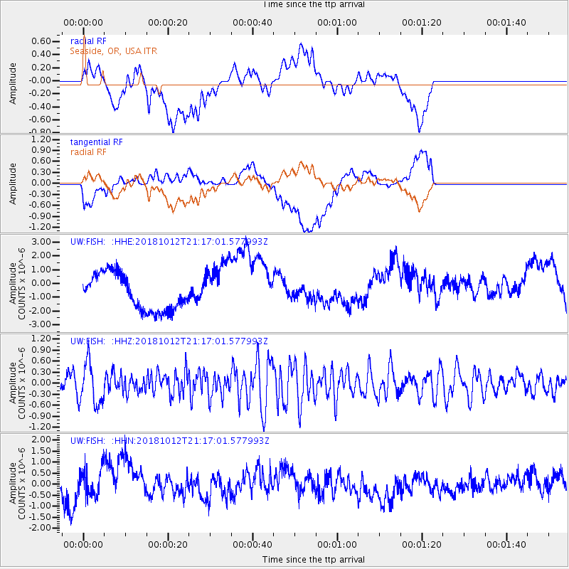
Signal To Noise
| Channel | StoN | STA | LTA |
| UW:FISH: :HHZ:20181012T21:17:01.577993Z | 2.3252056 | 5.803478E-7 | 2.495899E-7 |
| UW:FISH: :HHN:20181012T21:17:01.577993Z | 0.6187615 | 6.239398E-7 | 1.0083688E-6 |
| UW:FISH: :HHE:20181012T21:17:01.577993Z | 1.457529 | 1.8742378E-6 | 1.2859009E-6 |
| Arrivals |
| Ps | |
| PpPs | |
| PsPs/PpSs | |


