You are here: Home > Network List > PF - Volcanologic Network of Piton de Fournaise-OVPF Stations List
> Station HIM cratere Himiltrude > Earthquake Result Viewer
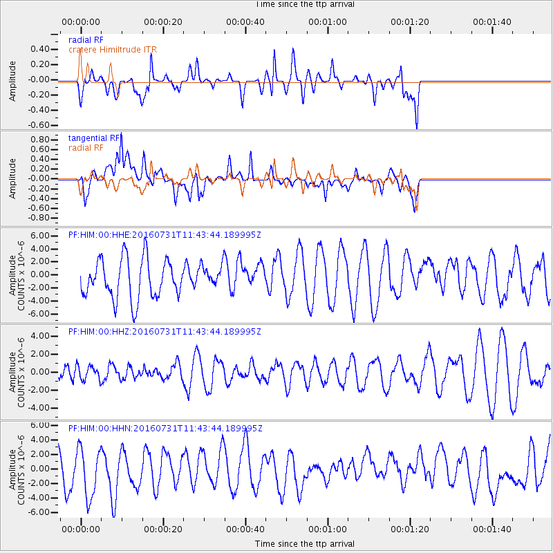
HIM cratere Himiltrude - Earthquake Result Viewer
*The percent match for this event was below the threshold and hence no stack was calculated.
| Earthquake location: |
South Sandwich Islands Region |
| Earthquake latitude/longitude: |
-56.3/-27.5 |
| Earthquake time(UTC): |
2016/07/31 (213) 11:33:20 GMT |
| Earthquake Depth: |
98 km |
| Earthquake Magnitude: |
5.9 MWW, 5.9 MWC, 5.9 MWB |
| Earthquake Catalog/Contributor: |
NEIC PDE/NEIC COMCAT |
|
| Network: |
PF Volcanologic Network of Piton de Fournaise-OVPF |
| Station: |
HIM cratere Himiltrude |
| Lat/Lon: |
21.21 S/55.72 E |
| Elevation: |
1958 m |
|
| Distance: |
68.9 deg |
| Az: |
96.77 deg |
| Baz: |
216.437 deg |
| Ray Param: |
$rayparam |
*The percent match for this event was below the threshold and hence was not used in the summary stack. |
|
| Radial Match: |
58.983513 % |
| Radial Bump: |
400 |
| Transverse Match: |
60.6766 % |
| Transverse Bump: |
400 |
| SOD ConfigId: |
1634031 |
| Insert Time: |
2016-08-14 11:35:14.450 +0000 |
| GWidth: |
2.5 |
| Max Bumps: |
400 |
| Tol: |
0.001 |
|
Signal To Noise
| Channel | StoN | STA | LTA |
| PF:HIM:00:HHZ:20160731T11:43:44.189995Z | 0.5203692 | 7.817059E-7 | 1.5022141E-6 |
| PF:HIM:00:HHN:20160731T11:43:44.189995Z | 2.034782 | 3.5187222E-6 | 1.7292872E-6 |
| PF:HIM:00:HHE:20160731T11:43:44.189995Z | 0.58863986 | 1.8026418E-6 | 3.062385E-6 |
| Arrivals |
| Ps | |
| PpPs | |
| PsPs/PpSs | |


