You are here: Home > Network List > TA - USArray Transportable Network (new EarthScope stations) Stations List
> Station H15A Lima, MT, USA > Earthquake Result Viewer
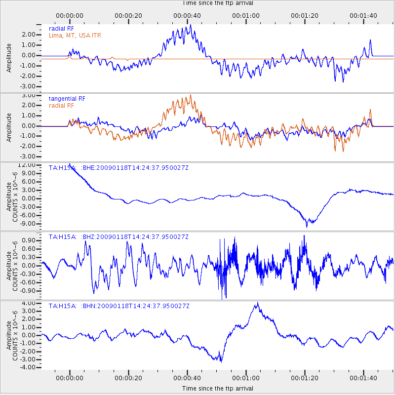
H15A Lima, MT, USA - Earthquake Result Viewer
*The percent match for this event was below the threshold and hence no stack was calculated.
| Earthquake location: |
Kermadec Islands, New Zealand |
| Earthquake latitude/longitude: |
-30.2/-178.0 |
| Earthquake time(UTC): |
2009/01/18 (018) 14:11:48 GMT |
| Earthquake Depth: |
33 km |
| Earthquake Magnitude: |
6.0 MB, 6.1 MS, 6.4 MW, 6.4 MW |
| Earthquake Catalog/Contributor: |
WHDF/NEIC |
|
| Network: |
TA USArray Transportable Network (new EarthScope stations) |
| Station: |
H15A Lima, MT, USA |
| Lat/Lon: |
44.62 N/112.64 W |
| Elevation: |
1957 m |
|
| Distance: |
95.3 deg |
| Az: |
40.665 deg |
| Baz: |
232.179 deg |
| Ray Param: |
$rayparam |
*The percent match for this event was below the threshold and hence was not used in the summary stack. |
|
| Radial Match: |
48.58482 % |
| Radial Bump: |
400 |
| Transverse Match: |
31.29208 % |
| Transverse Bump: |
400 |
| SOD ConfigId: |
2658 |
| Insert Time: |
2010-03-06 16:49:11.029 +0000 |
| GWidth: |
2.5 |
| Max Bumps: |
400 |
| Tol: |
0.001 |
|
Signal To Noise
| Channel | StoN | STA | LTA |
| TA:H15A: :BHZ:20090118T14:24:37.950027Z | 1.2956606 | 1.752875E-7 | 1.3528813E-7 |
| TA:H15A: :BHN:20090118T14:24:37.950027Z | 0.7747917 | 2.4604503E-7 | 3.175628E-7 |
| TA:H15A: :BHE:20090118T14:24:37.950027Z | 0.86525446 | 3.3892281E-6 | 3.917031E-6 |
| Arrivals |
| Ps | |
| PpPs | |
| PsPs/PpSs | |


