You are here: Home > Network List > TA - USArray Transportable Network (new EarthScope stations) Stations List
> Station M16K Timber Creek, AK, USA > Earthquake Result Viewer
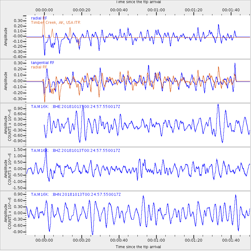
M16K Timber Creek, AK, USA - Earthquake Result Viewer
*The percent match for this event was below the threshold and hence no stack was calculated.
| Earthquake location: |
Vanuatu Islands |
| Earthquake latitude/longitude: |
-13.7/167.2 |
| Earthquake time(UTC): |
2018/10/13 (286) 00:13:46 GMT |
| Earthquake Depth: |
199 km |
| Earthquake Magnitude: |
5.7 Mww |
| Earthquake Catalog/Contributor: |
NEIC PDE/us |
|
| Network: |
TA USArray Transportable Network (new EarthScope stations) |
| Station: |
M16K Timber Creek, AK, USA |
| Lat/Lon: |
61.02 N/158.96 W |
| Elevation: |
394 m |
|
| Distance: |
79.2 deg |
| Az: |
16.021 deg |
| Baz: |
213.428 deg |
| Ray Param: |
$rayparam |
*The percent match for this event was below the threshold and hence was not used in the summary stack. |
|
| Radial Match: |
47.686264 % |
| Radial Bump: |
400 |
| Transverse Match: |
49.204704 % |
| Transverse Bump: |
348 |
| SOD ConfigId: |
13570011 |
| Insert Time: |
2019-05-01 12:28:51.939 +0000 |
| GWidth: |
2.5 |
| Max Bumps: |
400 |
| Tol: |
0.001 |
|
Signal To Noise
| Channel | StoN | STA | LTA |
| TA:M16K: :BHZ:20181013T00:24:57.550017Z | 2.6758678 | 6.910328E-7 | 2.5824625E-7 |
| TA:M16K: :BHN:20181013T00:24:57.550017Z | 1.8318541 | 4.1740813E-7 | 2.2786101E-7 |
| TA:M16K: :BHE:20181013T00:24:57.550017Z | 0.58007705 | 2.3976338E-7 | 4.133302E-7 |
| Arrivals |
| Ps | |
| PpPs | |
| PsPs/PpSs | |


