You are here: Home > Network List > TA - USArray Transportable Network (new EarthScope stations) Stations List
> Station H15A Lima, MT, USA > Earthquake Result Viewer
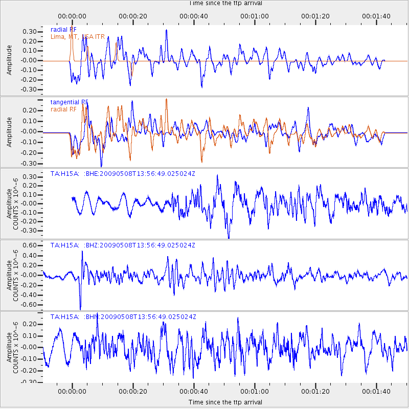
H15A Lima, MT, USA - Earthquake Result Viewer
*The percent match for this event was below the threshold and hence no stack was calculated.
| Earthquake location: |
Mendoza Province, Argentina |
| Earthquake latitude/longitude: |
-32.1/-69.7 |
| Earthquake time(UTC): |
2009/05/08 (128) 13:44:53 GMT |
| Earthquake Depth: |
112 km |
| Earthquake Magnitude: |
5.6 MB, 5.4 MW |
| Earthquake Catalog/Contributor: |
WHDF/NEIC |
|
| Network: |
TA USArray Transportable Network (new EarthScope stations) |
| Station: |
H15A Lima, MT, USA |
| Lat/Lon: |
44.62 N/112.64 W |
| Elevation: |
1957 m |
|
| Distance: |
85.8 deg |
| Az: |
330.785 deg |
| Baz: |
144.527 deg |
| Ray Param: |
$rayparam |
*The percent match for this event was below the threshold and hence was not used in the summary stack. |
|
| Radial Match: |
63.868435 % |
| Radial Bump: |
400 |
| Transverse Match: |
65.744896 % |
| Transverse Bump: |
400 |
| SOD ConfigId: |
2760 |
| Insert Time: |
2010-03-06 16:49:54.796 +0000 |
| GWidth: |
2.5 |
| Max Bumps: |
400 |
| Tol: |
0.001 |
|
Signal To Noise
| Channel | StoN | STA | LTA |
| TA:H15A: :BHZ:20090508T13:56:49.025024Z | 3.9566364 | 2.2732965E-7 | 5.745528E-8 |
| TA:H15A: :BHN:20090508T13:56:49.025024Z | 0.9179337 | 8.720003E-8 | 9.4996004E-8 |
| TA:H15A: :BHE:20090508T13:56:49.025024Z | 0.8226848 | 5.4298187E-8 | 6.6001206E-8 |
| Arrivals |
| Ps | |
| PpPs | |
| PsPs/PpSs | |


