You are here: Home > Network List > TA - USArray Transportable Network (new EarthScope stations) Stations List
> Station F20K Avaraart Lake, AK, USA > Earthquake Result Viewer
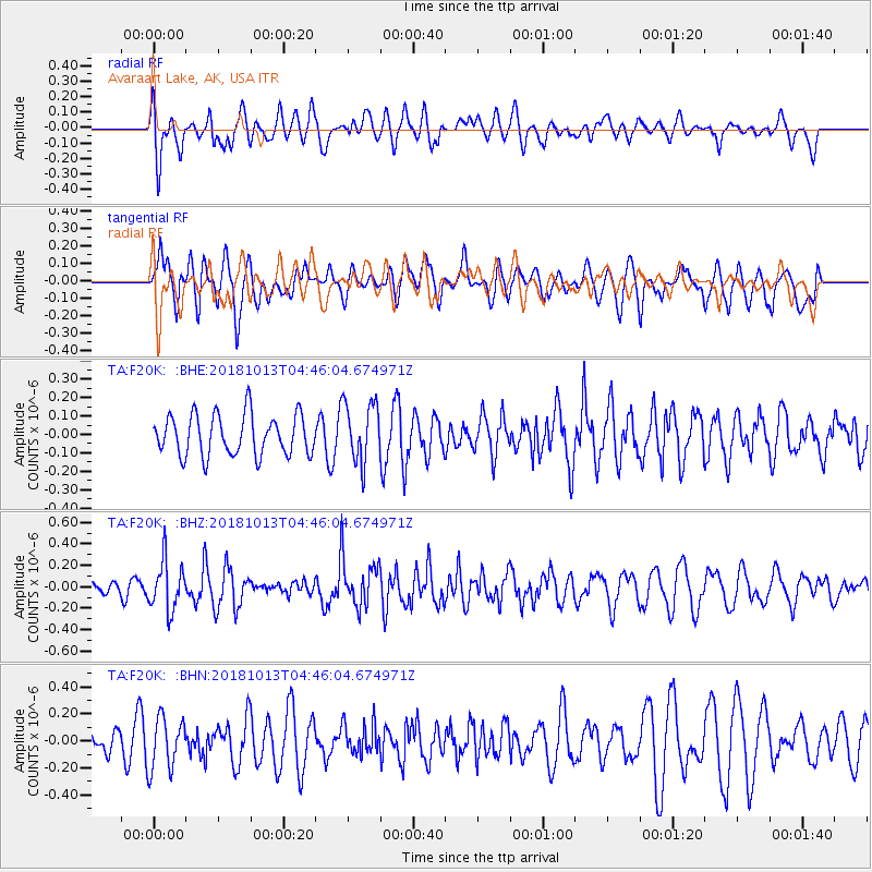
F20K Avaraart Lake, AK, USA - Earthquake Result Viewer
*The percent match for this event was below the threshold and hence no stack was calculated.
| Earthquake location: |
Northern Molucca Sea |
| Earthquake latitude/longitude: |
1.5/125.4 |
| Earthquake time(UTC): |
2018/10/13 (286) 04:34:15 GMT |
| Earthquake Depth: |
106 km |
| Earthquake Magnitude: |
5.2 Mww |
| Earthquake Catalog/Contributor: |
NEIC PDE/us |
|
| Network: |
TA USArray Transportable Network (new EarthScope stations) |
| Station: |
F20K Avaraart Lake, AK, USA |
| Lat/Lon: |
67.05 N/155.73 W |
| Elevation: |
136 m |
|
| Distance: |
84.3 deg |
| Az: |
22.749 deg |
| Baz: |
260.304 deg |
| Ray Param: |
$rayparam |
*The percent match for this event was below the threshold and hence was not used in the summary stack. |
|
| Radial Match: |
64.506714 % |
| Radial Bump: |
400 |
| Transverse Match: |
56.057537 % |
| Transverse Bump: |
400 |
| SOD ConfigId: |
13570011 |
| Insert Time: |
2019-05-01 12:33:17.319 +0000 |
| GWidth: |
2.5 |
| Max Bumps: |
400 |
| Tol: |
0.001 |
|
Signal To Noise
| Channel | StoN | STA | LTA |
| TA:F20K: :BHZ:20181013T04:46:04.674971Z | 2.0599964 | 2.2980258E-7 | 1.1155484E-7 |
| TA:F20K: :BHN:20181013T04:46:04.674971Z | 2.0038 | 1.9273796E-7 | 9.618622E-8 |
| TA:F20K: :BHE:20181013T04:46:04.674971Z | 1.4904248 | 1.6407925E-7 | 1.10088926E-7 |
| Arrivals |
| Ps | |
| PpPs | |
| PsPs/PpSs | |


