
BAR Barrett Dam, California, USA - Earthquake Result Viewer
| ||||||||||||||||||
| ||||||||||||||||||
| ||||||||||||||||||
|
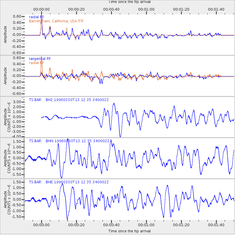
Signal To Noise
| Channel | StoN | STA | LTA |
| TS:BAR: :BHN:19960330T13:12:35.340002Z | 2.0889964 | 3.2773673E-7 | 1.5688717E-7 |
| TS:BAR: :BHE:19960330T13:12:35.340002Z | 2.6325872 | 2.4727257E-7 | 9.392758E-8 |
| TS:BAR: :BHZ:19960330T13:12:35.340002Z | 4.78521 | 9.026879E-7 | 1.8864122E-7 |
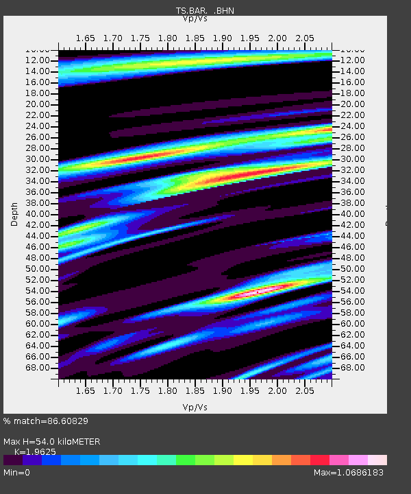
| Arrivals | |
| Ps | 8.8 SECOND |
| PpPs | 24 SECOND |
| PsPs/PpSs | 33 SECOND |

