You are here: Home > Network List > CI - Caltech Regional Seismic Network Stations List
> Station MLAC Mammoth Lakes, California, USA > Earthquake Result Viewer
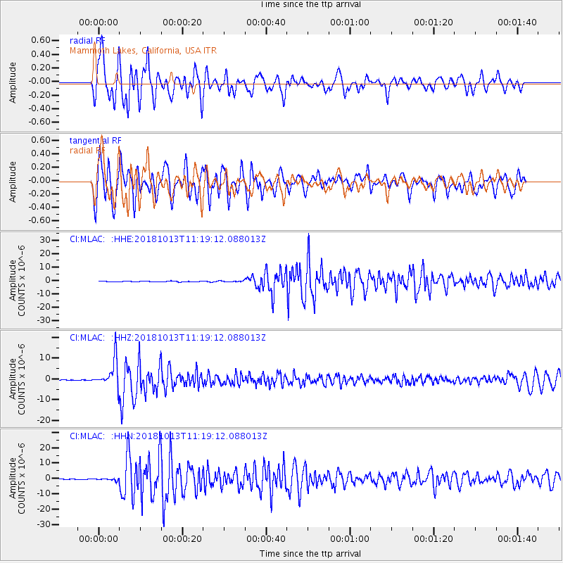
MLAC Mammoth Lakes, California, USA - Earthquake Result Viewer
*The percent match for this event was below the threshold and hence no stack was calculated.
| Earthquake location: |
Northwest Of Kuril Islands |
| Earthquake latitude/longitude: |
52.7/153.7 |
| Earthquake time(UTC): |
2018/10/13 (286) 11:10:19 GMT |
| Earthquake Depth: |
397 km |
| Earthquake Magnitude: |
6.7 Mi |
| Earthquake Catalog/Contributor: |
NEIC PDE/pt |
|
| Network: |
CI Caltech Regional Seismic Network |
| Station: |
MLAC Mammoth Lakes, California, USA |
| Lat/Lon: |
37.63 N/118.84 W |
| Elevation: |
2134 m |
|
| Distance: |
59.8 deg |
| Az: |
66.65 deg |
| Baz: |
315.271 deg |
| Ray Param: |
$rayparam |
*The percent match for this event was below the threshold and hence was not used in the summary stack. |
|
| Radial Match: |
83.9133 % |
| Radial Bump: |
400 |
| Transverse Match: |
81.065575 % |
| Transverse Bump: |
400 |
| SOD ConfigId: |
13570011 |
| Insert Time: |
2019-05-01 12:39:12.698 +0000 |
| GWidth: |
2.5 |
| Max Bumps: |
400 |
| Tol: |
0.001 |
|
Signal To Noise
| Channel | StoN | STA | LTA |
| CI:MLAC: :HHZ:20181013T11:19:12.088013Z | 64.782616 | 6.9879056E-6 | 1.0786699E-7 |
| CI:MLAC: :HHN:20181013T11:19:12.088013Z | 4.185508 | 6.904421E-7 | 1.6496018E-7 |
| CI:MLAC: :HHE:20181013T11:19:12.088013Z | 3.8452241 | 1.0436668E-6 | 2.7141897E-7 |
| Arrivals |
| Ps | |
| PpPs | |
| PsPs/PpSs | |


