
BAR Barrett Dam, California, USA - Earthquake Result Viewer
| ||||||||||||||||||
| ||||||||||||||||||
| ||||||||||||||||||
|
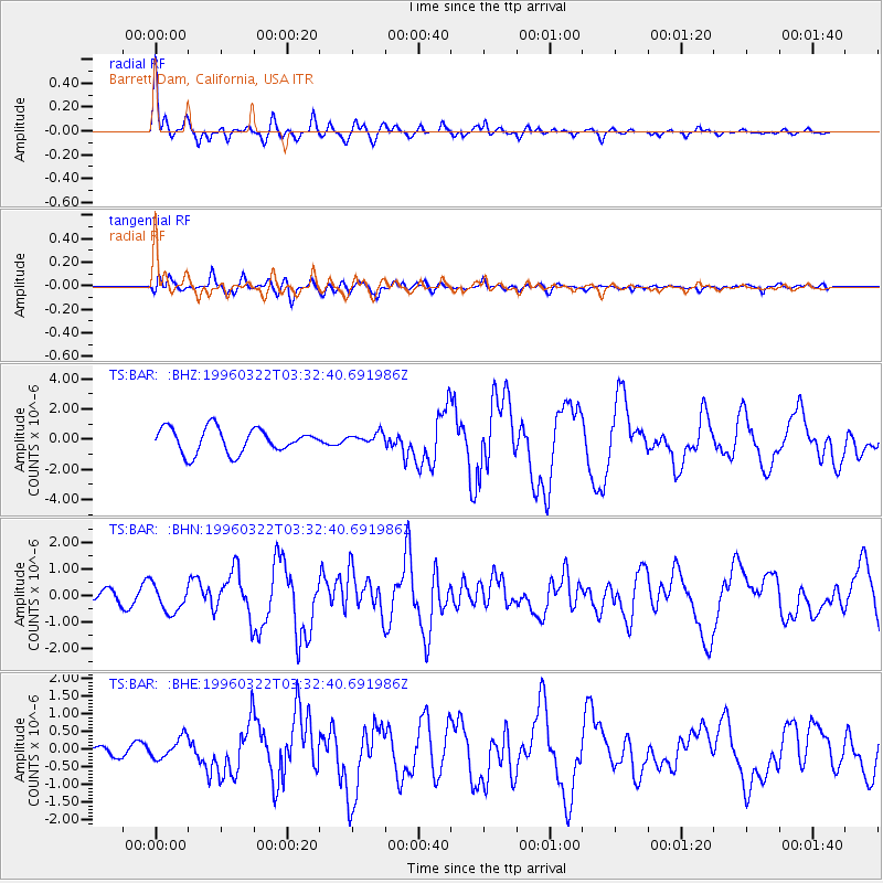
Signal To Noise
| Channel | StoN | STA | LTA |
| TS:BAR: :BHN:19960322T03:32:40.691986Z | 2.2229292 | 5.210827E-7 | 2.3441265E-7 |
| TS:BAR: :BHE:19960322T03:32:40.691986Z | 0.83125496 | 3.161817E-7 | 3.803667E-7 |
| TS:BAR: :BHZ:19960322T03:32:40.691986Z | 0.43688035 | 3.5469927E-7 | 8.118911E-7 |
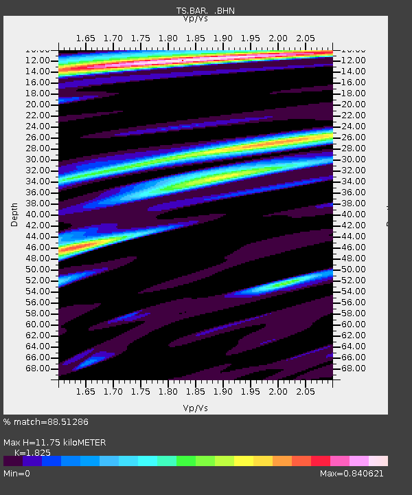
| Arrivals | |
| Ps | 1.6 SECOND |
| PpPs | 5.0 SECOND |
| PsPs/PpSs | 6.7 SECOND |

