You are here: Home > Network List > CN - Canadian National Seismograph Network Stations List
> Station LLLB Lillooet, BC, CA > Earthquake Result Viewer
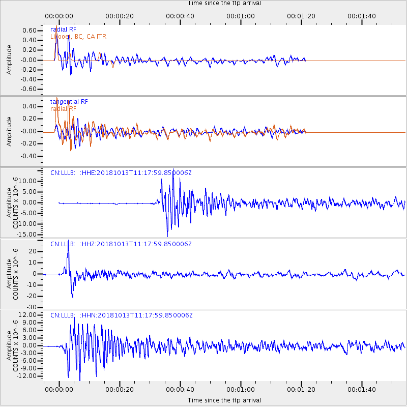
LLLB Lillooet, BC, CA - Earthquake Result Viewer
*The percent match for this event was below the threshold and hence no stack was calculated.
| Earthquake location: |
Northwest Of Kuril Islands |
| Earthquake latitude/longitude: |
52.7/153.7 |
| Earthquake time(UTC): |
2018/10/13 (286) 11:10:19 GMT |
| Earthquake Depth: |
397 km |
| Earthquake Magnitude: |
6.7 Mi |
| Earthquake Catalog/Contributor: |
NEIC PDE/pt |
|
| Network: |
CN Canadian National Seismograph Network |
| Station: |
LLLB Lillooet, BC, CA |
| Lat/Lon: |
50.61 N/121.88 W |
| Elevation: |
700 m |
|
| Distance: |
49.5 deg |
| Az: |
56.476 deg |
| Baz: |
307.223 deg |
| Ray Param: |
$rayparam |
*The percent match for this event was below the threshold and hence was not used in the summary stack. |
|
| Radial Match: |
71.484116 % |
| Radial Bump: |
400 |
| Transverse Match: |
66.62453 % |
| Transverse Bump: |
400 |
| SOD ConfigId: |
13570011 |
| Insert Time: |
2019-05-01 12:40:11.411 +0000 |
| GWidth: |
2.5 |
| Max Bumps: |
400 |
| Tol: |
0.001 |
|
Signal To Noise
| Channel | StoN | STA | LTA |
| CN:LLLB: :HHZ:20181013T11:17:59.850006Z | 56.542698 | 1.0067454E-5 | 1.7805047E-7 |
| CN:LLLB: :HHN:20181013T11:17:59.850006Z | 27.932207 | 4.1721078E-6 | 1.4936549E-7 |
| CN:LLLB: :HHE:20181013T11:17:59.850006Z | 30.263325 | 3.5278297E-6 | 1.16571115E-7 |
| Arrivals |
| Ps | |
| PpPs | |
| PsPs/PpSs | |


