You are here: Home > Network List > IC - New China Digital Seismograph Network Stations List
> Station KMI Kunming, Yunnan Province, China > Earthquake Result Viewer
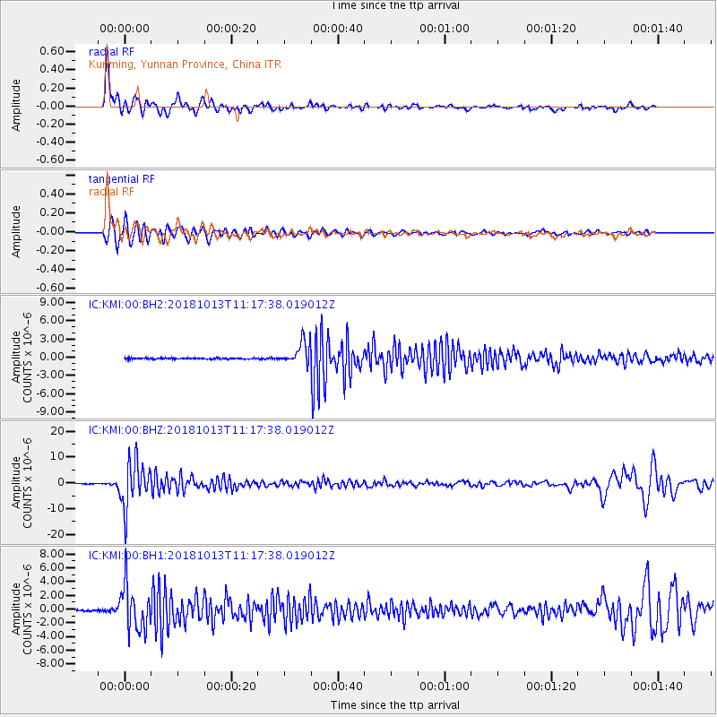
KMI Kunming, Yunnan Province, China - Earthquake Result Viewer
*The percent match for this event was below the threshold and hence no stack was calculated.
| Earthquake location: |
Northwest Of Kuril Islands |
| Earthquake latitude/longitude: |
52.7/153.7 |
| Earthquake time(UTC): |
2018/10/13 (286) 11:10:19 GMT |
| Earthquake Depth: |
397 km |
| Earthquake Magnitude: |
6.7 Mi |
| Earthquake Catalog/Contributor: |
NEIC PDE/pt |
|
| Network: |
IC New China Digital Seismograph Network |
| Station: |
KMI Kunming, Yunnan Province, China |
| Lat/Lon: |
25.12 N/102.74 E |
| Elevation: |
1975 m |
|
| Distance: |
46.9 deg |
| Az: |
254.413 deg |
| Baz: |
40.292 deg |
| Ray Param: |
$rayparam |
*The percent match for this event was below the threshold and hence was not used in the summary stack. |
|
| Radial Match: |
89.96405 % |
| Radial Bump: |
400 |
| Transverse Match: |
77.756065 % |
| Transverse Bump: |
400 |
| SOD ConfigId: |
13570011 |
| Insert Time: |
2019-05-01 12:41:45.099 +0000 |
| GWidth: |
2.5 |
| Max Bumps: |
400 |
| Tol: |
0.001 |
|
Signal To Noise
| Channel | StoN | STA | LTA |
| IC:KMI:00:BHZ:20181013T11:17:38.019012Z | 82.09041 | 8.9271725E-6 | 1.0874806E-7 |
| IC:KMI:00:BH1:20181013T11:17:38.019012Z | 27.28022 | 3.2571504E-6 | 1.1939605E-7 |
| IC:KMI:00:BH2:20181013T11:17:38.019012Z | 49.216663 | 4.3434347E-6 | 8.8251305E-8 |
| Arrivals |
| Ps | |
| PpPs | |
| PsPs/PpSs | |


