You are here: Home > Network List > IU - Global Seismograph Network (GSN - IRIS/USGS) Stations List
> Station FURI Mt. Furi, Ethiopia > Earthquake Result Viewer
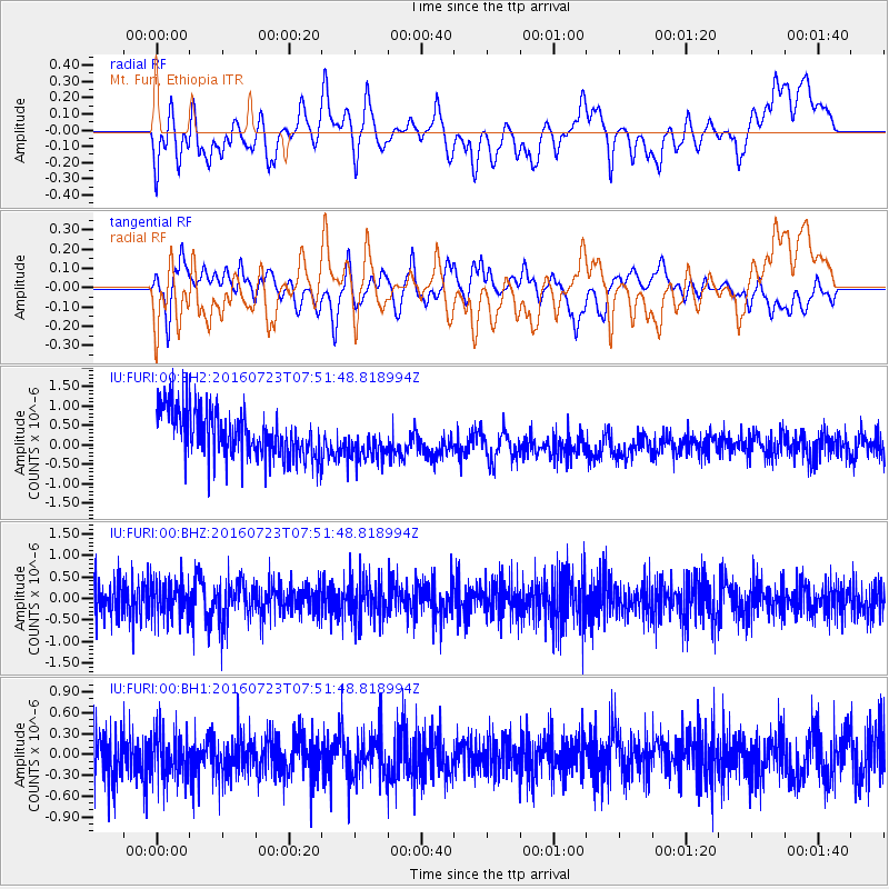
FURI Mt. Furi, Ethiopia - Earthquake Result Viewer
*The percent match for this event was below the threshold and hence no stack was calculated.
| Earthquake location: |
Southwest Of Sumatra, Indonesia |
| Earthquake latitude/longitude: |
-6.8/101.2 |
| Earthquake time(UTC): |
2016/07/23 (205) 07:41:44 GMT |
| Earthquake Depth: |
10 km |
| Earthquake Magnitude: |
5.5 MWW, 5.5 MWB, 5.5 MWC |
| Earthquake Catalog/Contributor: |
NEIC PDE/NEIC COMCAT |
|
| Network: |
IU Global Seismograph Network (GSN - IRIS/USGS) |
| Station: |
FURI Mt. Furi, Ethiopia |
| Lat/Lon: |
8.90 N/38.68 E |
| Elevation: |
2570 m |
|
| Distance: |
64.2 deg |
| Az: |
283.213 deg |
| Baz: |
101.913 deg |
| Ray Param: |
$rayparam |
*The percent match for this event was below the threshold and hence was not used in the summary stack. |
|
| Radial Match: |
28.955557 % |
| Radial Bump: |
400 |
| Transverse Match: |
35.756687 % |
| Transverse Bump: |
400 |
| SOD ConfigId: |
1634031 |
| Insert Time: |
2016-08-17 06:45:47.854 +0000 |
| GWidth: |
2.5 |
| Max Bumps: |
400 |
| Tol: |
0.001 |
|
Signal To Noise
| Channel | StoN | STA | LTA |
| IU:FURI:00:BHZ:20160723T07:51:48.818994Z | 0.71770054 | 4.20429E-7 | 5.858E-7 |
| IU:FURI:00:BH1:20160723T07:51:48.818994Z | 0.6339726 | 3.633099E-7 | 5.7306875E-7 |
| IU:FURI:00:BH2:20160723T07:51:48.818994Z | 0.83931077 | 5.209072E-7 | 6.206368E-7 |
| Arrivals |
| Ps | |
| PpPs | |
| PsPs/PpSs | |


