You are here: Home > Network List > TA - USArray Transportable Network (new EarthScope stations) Stations List
> Station Z21A St. Cloud Mine, Winston, NM, USA > Earthquake Result Viewer
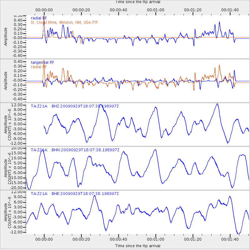
Z21A St. Cloud Mine, Winston, NM, USA - Earthquake Result Viewer
*The percent match for this event was below the threshold and hence no stack was calculated.
| Earthquake location: |
Tonga Islands |
| Earthquake latitude/longitude: |
-15.4/-173.2 |
| Earthquake time(UTC): |
2009/09/29 (272) 17:56:05 GMT |
| Earthquake Depth: |
10 km |
| Earthquake Magnitude: |
6.0 MB |
| Earthquake Catalog/Contributor: |
WHDF/NEIC |
|
| Network: |
TA USArray Transportable Network (new EarthScope stations) |
| Station: |
Z21A St. Cloud Mine, Winston, NM, USA |
| Lat/Lon: |
33.31 N/107.67 W |
| Elevation: |
1964 m |
|
| Distance: |
79.0 deg |
| Az: |
50.922 deg |
| Baz: |
243.423 deg |
| Ray Param: |
$rayparam |
*The percent match for this event was below the threshold and hence was not used in the summary stack. |
|
| Radial Match: |
62.68479 % |
| Radial Bump: |
400 |
| Transverse Match: |
60.94864 % |
| Transverse Bump: |
395 |
| SOD ConfigId: |
2622 |
| Insert Time: |
2010-03-06 16:55:28.147 +0000 |
| GWidth: |
2.5 |
| Max Bumps: |
400 |
| Tol: |
0.001 |
|
Signal To Noise
| Channel | StoN | STA | LTA |
| TA:Z21A: :BHN:20090929T18:07:38.198997Z | 0.84919155 | 1.0276271E-5 | 1.210124E-5 |
| TA:Z21A: :BHE:20090929T18:07:38.198997Z | 0.8073433 | 3.1589143E-6 | 3.9127276E-6 |
| TA:Z21A: :BHZ:20090929T18:07:38.198997Z | 2.368568 | 1.0225698E-5 | 4.3172495E-6 |
| Arrivals |
| Ps | |
| PpPs | |
| PsPs/PpSs | |


