You are here: Home > Network List > TA - USArray Transportable Network (new EarthScope stations) Stations List
> Station Z21A St. Cloud Mine, Winston, NM, USA > Earthquake Result Viewer
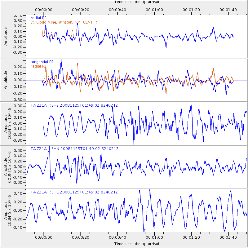
Z21A St. Cloud Mine, Winston, NM, USA - Earthquake Result Viewer
*The percent match for this event was below the threshold and hence no stack was calculated.
| Earthquake location: |
Kermadec Islands, New Zealand |
| Earthquake latitude/longitude: |
-30.2/-177.9 |
| Earthquake time(UTC): |
2008/11/25 (330) 01:36:30 GMT |
| Earthquake Depth: |
35 km |
| Earthquake Magnitude: |
5.6 MB, 5.3 MS, 5.6 MW, 5.6 MW |
| Earthquake Catalog/Contributor: |
WHDF/NEIC |
|
| Network: |
TA USArray Transportable Network (new EarthScope stations) |
| Station: |
Z21A St. Cloud Mine, Winston, NM, USA |
| Lat/Lon: |
33.31 N/107.67 W |
| Elevation: |
1964 m |
|
| Distance: |
91.6 deg |
| Az: |
52.022 deg |
| Baz: |
234.543 deg |
| Ray Param: |
$rayparam |
*The percent match for this event was below the threshold and hence was not used in the summary stack. |
|
| Radial Match: |
49.6371 % |
| Radial Bump: |
394 |
| Transverse Match: |
63.526943 % |
| Transverse Bump: |
400 |
| SOD ConfigId: |
2658 |
| Insert Time: |
2010-03-06 16:55:49.790 +0000 |
| GWidth: |
2.5 |
| Max Bumps: |
400 |
| Tol: |
0.001 |
|
Signal To Noise
| Channel | StoN | STA | LTA |
| TA:Z21A: :BHN:20081125T01:49:02.824021Z | 2.9341185 | 3.662109E-7 | 1.2481122E-7 |
| TA:Z21A: :BHE:20081125T01:49:02.824021Z | 0.92327434 | 1.1663155E-7 | 1.2632383E-7 |
| TA:Z21A: :BHZ:20081125T01:49:02.824021Z | 1.0092407 | 1.2973203E-7 | 1.2854417E-7 |
| Arrivals |
| Ps | |
| PpPs | |
| PsPs/PpSs | |


