You are here: Home > Network List > UW - Pacific Northwest Regional Seismic Network Stations List
> Station FISH Seaside, OR, USA > Earthquake Result Viewer
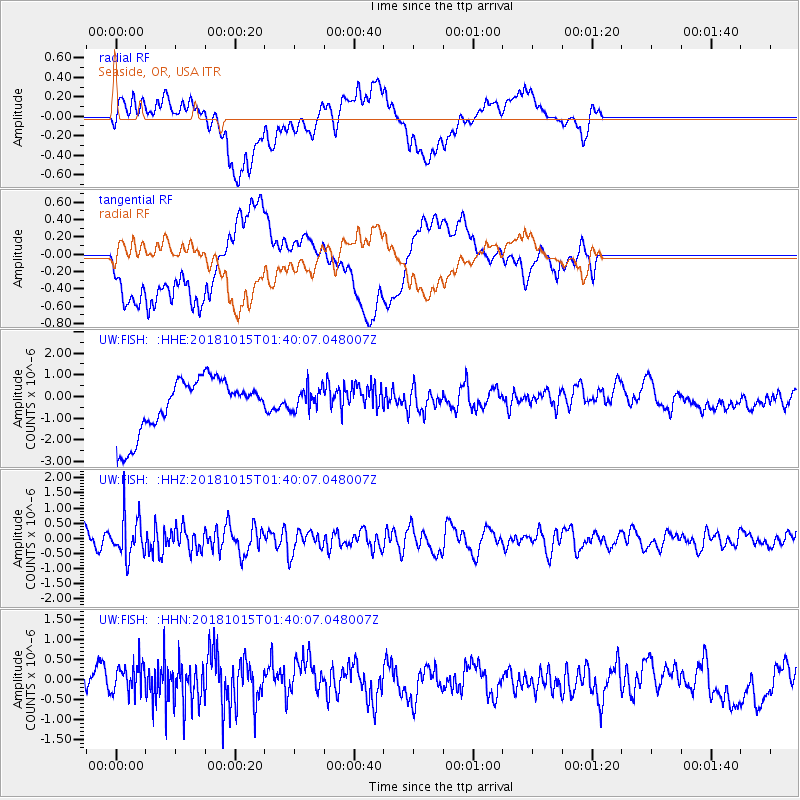
FISH Seaside, OR, USA - Earthquake Result Viewer
*The percent match for this event was below the threshold and hence no stack was calculated.
| Earthquake location: |
Near East Coast Of Kamchatka |
| Earthquake latitude/longitude: |
54.1/159.5 |
| Earthquake time(UTC): |
2018/10/15 (288) 01:32:12 GMT |
| Earthquake Depth: |
124 km |
| Earthquake Magnitude: |
5.6 mb |
| Earthquake Catalog/Contributor: |
NEIC PDE/us |
|
| Network: |
UW Pacific Northwest Regional Seismic Network |
| Station: |
FISH Seaside, OR, USA |
| Lat/Lon: |
45.93 N/123.56 W |
| Elevation: |
325 m |
|
| Distance: |
47.8 deg |
| Az: |
66.539 deg |
| Baz: |
309.218 deg |
| Ray Param: |
$rayparam |
*The percent match for this event was below the threshold and hence was not used in the summary stack. |
|
| Radial Match: |
31.328314 % |
| Radial Bump: |
400 |
| Transverse Match: |
30.134441 % |
| Transverse Bump: |
400 |
| SOD ConfigId: |
13570011 |
| Insert Time: |
2019-05-01 13:06:09.851 +0000 |
| GWidth: |
2.5 |
| Max Bumps: |
400 |
| Tol: |
0.001 |
|
Signal To Noise
| Channel | StoN | STA | LTA |
| UW:FISH: :HHZ:20181015T01:40:07.048007Z | 2.3832214 | 6.72386E-7 | 2.8213324E-7 |
| UW:FISH: :HHN:20181015T01:40:07.048007Z | 0.8736587 | 4.276755E-7 | 4.895224E-7 |
| UW:FISH: :HHE:20181015T01:40:07.048007Z | 0.43916598 | 5.3866324E-7 | 1.2265596E-6 |
| Arrivals |
| Ps | |
| PpPs | |
| PsPs/PpSs | |


