
BAR Barrett Dam, California, USA - Earthquake Result Viewer
| ||||||||||||||||||
| ||||||||||||||||||
| ||||||||||||||||||
|
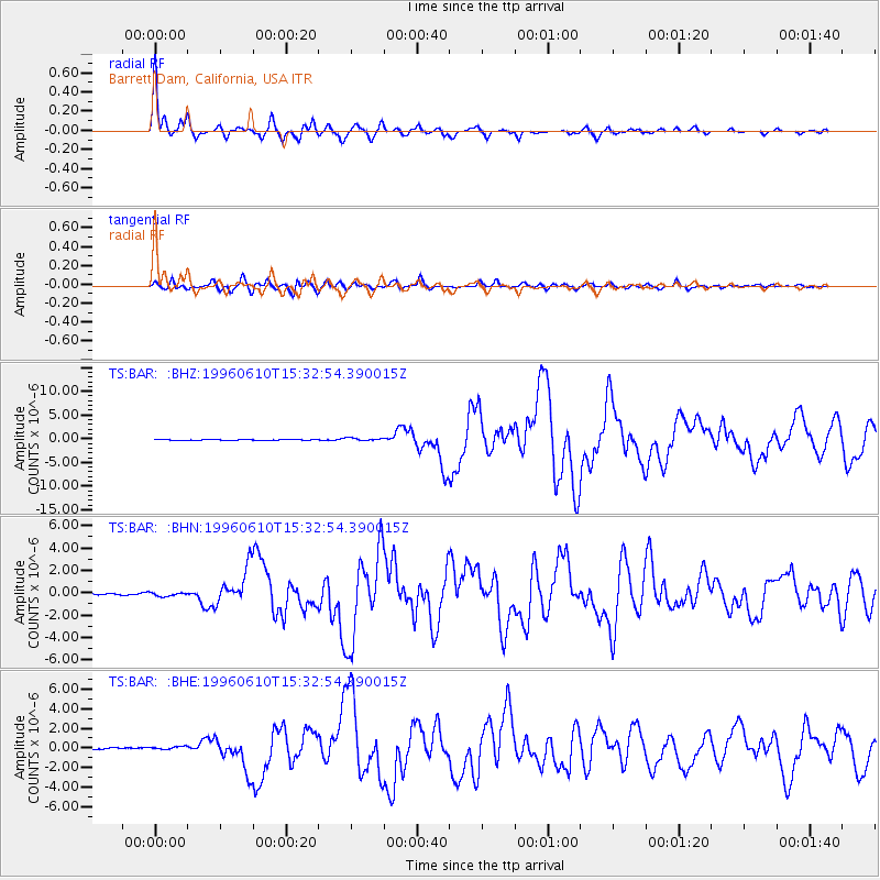
Signal To Noise
| Channel | StoN | STA | LTA |
| TS:BAR: :BHN:19960610T15:32:54.390015Z | 1.7059822 | 1.891477E-7 | 1.10873195E-7 |
| TS:BAR: :BHE:19960610T15:32:54.390015Z | 2.2947366 | 1.9805225E-7 | 8.6307175E-8 |
| TS:BAR: :BHZ:19960610T15:32:54.390015Z | 4.3417015 | 2.939515E-7 | 6.7704214E-8 |
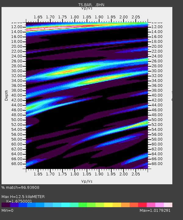
| Arrivals | |
| Ps | 1.4 SECOND |
| PpPs | 5.0 SECOND |
| PsPs/PpSs | 6.5 SECOND |

