You are here: Home > Network List > TA - USArray Transportable Network (new EarthScope stations) Stations List
> Station Z21A St. Cloud Mine, Winston, NM, USA > Earthquake Result Viewer
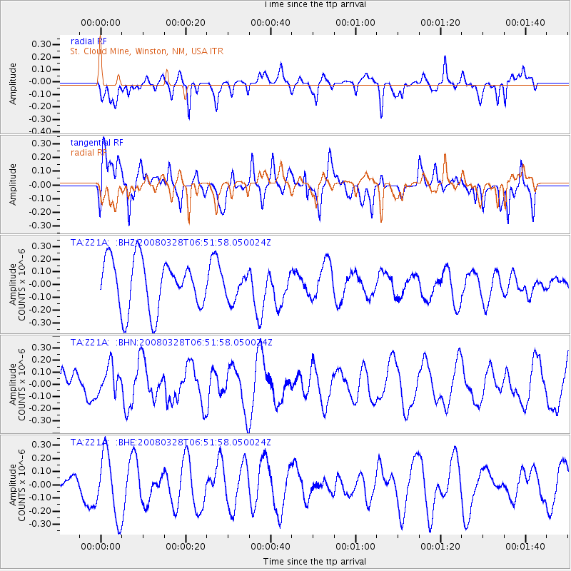
Z21A St. Cloud Mine, Winston, NM, USA - Earthquake Result Viewer
*The percent match for this event was below the threshold and hence no stack was calculated.
| Earthquake location: |
South Of Kermadec Islands |
| Earthquake latitude/longitude: |
-32.9/179.4 |
| Earthquake time(UTC): |
2008/03/28 (088) 06:39:47 GMT |
| Earthquake Depth: |
365 km |
| Earthquake Magnitude: |
5.6 MW, 5.3 MB, 5.5 MW |
| Earthquake Catalog/Contributor: |
WHDF/NEIC |
|
| Network: |
TA USArray Transportable Network (new EarthScope stations) |
| Station: |
Z21A St. Cloud Mine, Winston, NM, USA |
| Lat/Lon: |
33.31 N/107.67 W |
| Elevation: |
1964 m |
|
| Distance: |
95.1 deg |
| Az: |
53.501 deg |
| Baz: |
233.875 deg |
| Ray Param: |
$rayparam |
*The percent match for this event was below the threshold and hence was not used in the summary stack. |
|
| Radial Match: |
56.14309 % |
| Radial Bump: |
400 |
| Transverse Match: |
54.946358 % |
| Transverse Bump: |
400 |
| SOD ConfigId: |
2504 |
| Insert Time: |
2010-03-06 16:56:16.112 +0000 |
| GWidth: |
2.5 |
| Max Bumps: |
400 |
| Tol: |
0.001 |
|
Signal To Noise
| Channel | StoN | STA | LTA |
| TA:Z21A: :BHN:20080328T06:51:58.050024Z | 0.98984474 | 1.1931132E-7 | 1.2053539E-7 |
| TA:Z21A: :BHE:20080328T06:51:58.050024Z | 2.4869075 | 2.4354674E-7 | 9.793156E-8 |
| TA:Z21A: :BHZ:20080328T06:51:58.050024Z | 0.5273514 | 1.03793454E-7 | 1.9682028E-7 |
| Arrivals |
| Ps | |
| PpPs | |
| PsPs/PpSs | |


