You are here: Home > Network List > AK - Alaska Regional Network Stations List
> Station CUT Chulitna, AK, USA > Earthquake Result Viewer
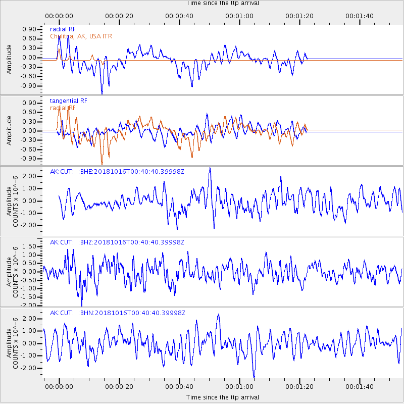
CUT Chulitna, AK, USA - Earthquake Result Viewer
*The percent match for this event was below the threshold and hence no stack was calculated.
| Earthquake location: |
Southeast Of Loyalty Islands |
| Earthquake latitude/longitude: |
-21.9/169.5 |
| Earthquake time(UTC): |
2018/10/16 (289) 00:28:12 GMT |
| Earthquake Depth: |
10 km |
| Earthquake Magnitude: |
6.3 Mww |
| Earthquake Catalog/Contributor: |
NEIC PDE/us |
|
| Network: |
AK Alaska Regional Network |
| Station: |
CUT Chulitna, AK, USA |
| Lat/Lon: |
62.41 N/150.26 W |
| Elevation: |
574 m |
|
| Distance: |
89.9 deg |
| Az: |
17.514 deg |
| Baz: |
216.873 deg |
| Ray Param: |
$rayparam |
*The percent match for this event was below the threshold and hence was not used in the summary stack. |
|
| Radial Match: |
65.95969 % |
| Radial Bump: |
400 |
| Transverse Match: |
47.127766 % |
| Transverse Bump: |
400 |
| SOD ConfigId: |
13570011 |
| Insert Time: |
2019-05-01 13:14:33.821 +0000 |
| GWidth: |
2.5 |
| Max Bumps: |
400 |
| Tol: |
0.001 |
|
Signal To Noise
| Channel | StoN | STA | LTA |
| AK:CUT: :BHZ:20181016T00:40:40.39998Z | 2.1544554 | 5.518163E-7 | 2.5612798E-7 |
| AK:CUT: :BHN:20181016T00:40:40.39998Z | 1.0105331 | 9.582018E-7 | 9.482142E-7 |
| AK:CUT: :BHE:20181016T00:40:40.39998Z | 1.2806147 | 5.9357774E-7 | 4.6351002E-7 |
| Arrivals |
| Ps | |
| PpPs | |
| PsPs/PpSs | |


