You are here: Home > Network List > AZ - ANZA Regional Network Stations List
> Station FRD AZ.FRD > Earthquake Result Viewer
FRD AZ.FRD - Earthquake Result Viewer
*The percent match for this event was below the threshold and hence no stack was calculated.
| Earthquake location: |
Southeast Of Loyalty Islands |
| Earthquake latitude/longitude: |
-21.9/169.5 |
| Earthquake time(UTC): |
2018/10/16 (289) 00:28:12 GMT |
| Earthquake Depth: |
10 km |
| Earthquake Magnitude: |
6.3 Mww |
| Earthquake Catalog/Contributor: |
NEIC PDE/us |
|
| Network: |
AZ ANZA Regional Network |
| Station: |
FRD AZ.FRD |
| Lat/Lon: |
33.49 N/116.60 W |
| Elevation: |
1164 m |
|
| Distance: |
89.4 deg |
| Az: |
53.417 deg |
| Baz: |
243.151 deg |
| Ray Param: |
$rayparam |
*The percent match for this event was below the threshold and hence was not used in the summary stack. |
|
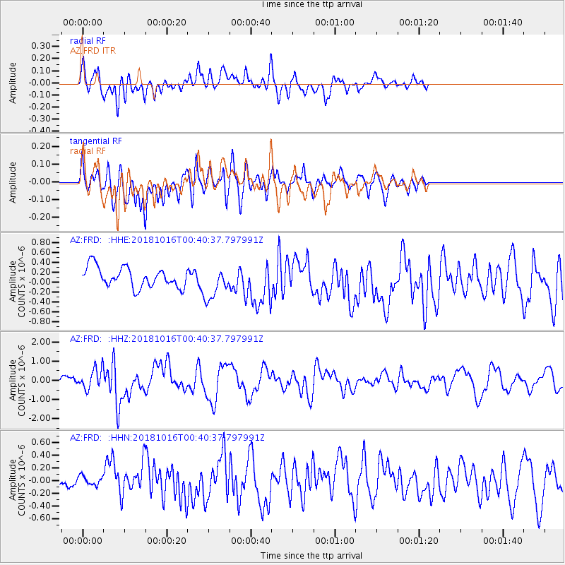
| Radial Match: |
75.68812 % |
| Radial Bump: |
400 |
| Transverse Match: |
55.429703 % |
| Transverse Bump: |
400 |
| SOD ConfigId: |
13570011 |
| Insert Time: |
2019-05-01 13:15:31.367 +0000 |
| GWidth: |
2.5 |
| Max Bumps: |
400 |
| Tol: |
0.001 |
|
Signal To Noise
| Channel | StoN | STA | LTA |
| AZ:FRD: :HHZ:20181016T00:40:37.797991Z | 3.9218166 | 5.4410026E-7 | 1.387368E-7 |
| AZ:FRD: :HHN:20181016T00:40:37.797991Z | 0.5068514 | 1.0919334E-7 | 2.1543462E-7 |
| AZ:FRD: :HHE:20181016T00:40:37.797991Z | 1.6241397 | 3.267753E-7 | 2.0119903E-7 |
| Arrivals |
| Ps | |
| PpPs | |
| PsPs/PpSs | |


