You are here: Home > Network List > CI - Caltech Regional Seismic Network Stations List
> Station SMM Simmler, CA, USA > Earthquake Result Viewer
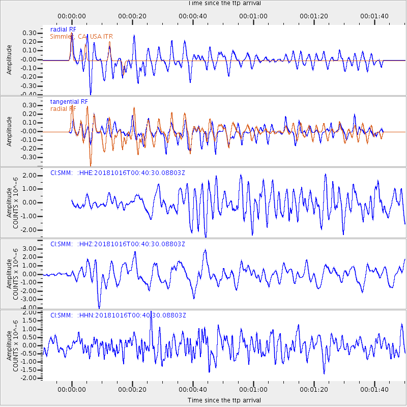
SMM Simmler, CA, USA - Earthquake Result Viewer
*The percent match for this event was below the threshold and hence no stack was calculated.
| Earthquake location: |
Southeast Of Loyalty Islands |
| Earthquake latitude/longitude: |
-21.9/169.5 |
| Earthquake time(UTC): |
2018/10/16 (289) 00:28:12 GMT |
| Earthquake Depth: |
10 km |
| Earthquake Magnitude: |
6.3 Mww |
| Earthquake Catalog/Contributor: |
NEIC PDE/us |
|
| Network: |
CI Caltech Regional Seismic Network |
| Station: |
SMM Simmler, CA, USA |
| Lat/Lon: |
35.31 N/120.00 W |
| Elevation: |
599 m |
|
| Distance: |
87.7 deg |
| Az: |
50.502 deg |
| Baz: |
241.169 deg |
| Ray Param: |
$rayparam |
*The percent match for this event was below the threshold and hence was not used in the summary stack. |
|
| Radial Match: |
69.28816 % |
| Radial Bump: |
400 |
| Transverse Match: |
65.36625 % |
| Transverse Bump: |
400 |
| SOD ConfigId: |
13570011 |
| Insert Time: |
2019-05-01 13:16:48.081 +0000 |
| GWidth: |
2.5 |
| Max Bumps: |
400 |
| Tol: |
0.001 |
|
Signal To Noise
| Channel | StoN | STA | LTA |
| CI:SMM: :HHZ:20181016T00:40:30.08803Z | 2.7669916 | 4.4232144E-7 | 1.5985644E-7 |
| CI:SMM: :HHN:20181016T00:40:30.08803Z | 0.8809203 | 3.5492633E-7 | 4.0290402E-7 |
| CI:SMM: :HHE:20181016T00:40:30.08803Z | 1.4895316 | 4.5753075E-7 | 3.0716416E-7 |
| Arrivals |
| Ps | |
| PpPs | |
| PsPs/PpSs | |


