You are here: Home > Network List > TA - USArray Transportable Network (new EarthScope stations) Stations List
> Station D23K Nanushuk River, AK USA > Earthquake Result Viewer
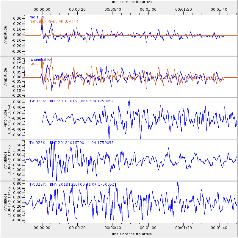
D23K Nanushuk River, AK USA - Earthquake Result Viewer
*The percent match for this event was below the threshold and hence no stack was calculated.
| Earthquake location: |
Southeast Of Loyalty Islands |
| Earthquake latitude/longitude: |
-21.9/169.5 |
| Earthquake time(UTC): |
2018/10/16 (289) 00:28:12 GMT |
| Earthquake Depth: |
10 km |
| Earthquake Magnitude: |
6.3 Mww |
| Earthquake Catalog/Contributor: |
NEIC PDE/us |
|
| Network: |
TA USArray Transportable Network (new EarthScope stations) |
| Station: |
D23K Nanushuk River, AK USA |
| Lat/Lon: |
68.97 N/150.68 W |
| Elevation: |
406 m |
|
| Distance: |
95.1 deg |
| Az: |
13.428 deg |
| Baz: |
216.672 deg |
| Ray Param: |
$rayparam |
*The percent match for this event was below the threshold and hence was not used in the summary stack. |
|
| Radial Match: |
72.61024 % |
| Radial Bump: |
400 |
| Transverse Match: |
44.24533 % |
| Transverse Bump: |
399 |
| SOD ConfigId: |
13570011 |
| Insert Time: |
2019-05-01 13:19:08.864 +0000 |
| GWidth: |
2.5 |
| Max Bumps: |
400 |
| Tol: |
0.001 |
|
Signal To Noise
| Channel | StoN | STA | LTA |
| TA:D23K: :BHZ:20181016T00:41:04.175005Z | 3.4350739 | 6.105911E-7 | 1.7775194E-7 |
| TA:D23K: :BHN:20181016T00:41:04.175005Z | 1.8193117 | 2.5252982E-7 | 1.3880515E-7 |
| TA:D23K: :BHE:20181016T00:41:04.175005Z | 1.3674412 | 1.5447374E-7 | 1.12965544E-7 |
| Arrivals |
| Ps | |
| PpPs | |
| PsPs/PpSs | |


