You are here: Home > Network List > TA - USArray Transportable Network (new EarthScope stations) Stations List
> Station D25K Kavik River, AK, USA > Earthquake Result Viewer
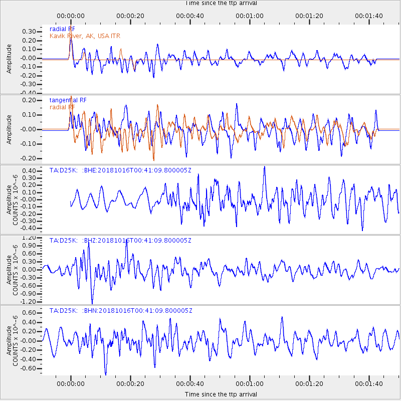
D25K Kavik River, AK, USA - Earthquake Result Viewer
*The percent match for this event was below the threshold and hence no stack was calculated.
| Earthquake location: |
Southeast Of Loyalty Islands |
| Earthquake latitude/longitude: |
-21.9/169.5 |
| Earthquake time(UTC): |
2018/10/16 (289) 00:28:12 GMT |
| Earthquake Depth: |
10 km |
| Earthquake Magnitude: |
6.3 Mww |
| Earthquake Catalog/Contributor: |
NEIC PDE/us |
|
| Network: |
TA USArray Transportable Network (new EarthScope stations) |
| Station: |
D25K Kavik River, AK, USA |
| Lat/Lon: |
69.32 N/146.38 W |
| Elevation: |
770 m |
|
| Distance: |
96.3 deg |
| Az: |
14.414 deg |
| Baz: |
220.594 deg |
| Ray Param: |
$rayparam |
*The percent match for this event was below the threshold and hence was not used in the summary stack. |
|
| Radial Match: |
66.695816 % |
| Radial Bump: |
400 |
| Transverse Match: |
69.90216 % |
| Transverse Bump: |
400 |
| SOD ConfigId: |
13570011 |
| Insert Time: |
2019-05-01 13:19:09.936 +0000 |
| GWidth: |
2.5 |
| Max Bumps: |
400 |
| Tol: |
0.001 |
|
Signal To Noise
| Channel | StoN | STA | LTA |
| TA:D25K: :BHZ:20181016T00:41:09.800005Z | 3.2252107 | 3.6461367E-7 | 1.13051115E-7 |
| TA:D25K: :BHN:20181016T00:41:09.800005Z | 0.8967699 | 1.1695997E-7 | 1.3042362E-7 |
| TA:D25K: :BHE:20181016T00:41:09.800005Z | 1.0599068 | 9.064003E-8 | 8.551697E-8 |
| Arrivals |
| Ps | |
| PpPs | |
| PsPs/PpSs | |


