You are here: Home > Network List > TA - USArray Transportable Network (new EarthScope stations) Stations List
> Station F26K Sheenjek River, AK, USA > Earthquake Result Viewer
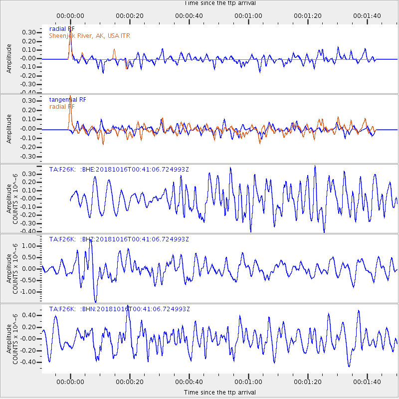
F26K Sheenjek River, AK, USA - Earthquake Result Viewer
*The percent match for this event was below the threshold and hence no stack was calculated.
| Earthquake location: |
Southeast Of Loyalty Islands |
| Earthquake latitude/longitude: |
-21.9/169.5 |
| Earthquake time(UTC): |
2018/10/16 (289) 00:28:12 GMT |
| Earthquake Depth: |
10 km |
| Earthquake Magnitude: |
6.3 Mww |
| Earthquake Catalog/Contributor: |
NEIC PDE/us |
|
| Network: |
TA USArray Transportable Network (new EarthScope stations) |
| Station: |
F26K Sheenjek River, AK, USA |
| Lat/Lon: |
67.69 N/144.15 W |
| Elevation: |
683 m |
|
| Distance: |
95.7 deg |
| Az: |
16.123 deg |
| Baz: |
222.488 deg |
| Ray Param: |
$rayparam |
*The percent match for this event was below the threshold and hence was not used in the summary stack. |
|
| Radial Match: |
63.044502 % |
| Radial Bump: |
400 |
| Transverse Match: |
60.767654 % |
| Transverse Bump: |
400 |
| SOD ConfigId: |
13570011 |
| Insert Time: |
2019-05-01 13:19:26.267 +0000 |
| GWidth: |
2.5 |
| Max Bumps: |
400 |
| Tol: |
0.001 |
|
Signal To Noise
| Channel | StoN | STA | LTA |
| TA:F26K: :BHZ:20181016T00:41:06.724993Z | 2.8170557 | 4.163243E-7 | 1.4778703E-7 |
| TA:F26K: :BHN:20181016T00:41:06.724993Z | 0.54898053 | 1.0568374E-7 | 1.9250908E-7 |
| TA:F26K: :BHE:20181016T00:41:06.724993Z | 0.6530226 | 7.7070005E-8 | 1.18020424E-7 |
| Arrivals |
| Ps | |
| PpPs | |
| PsPs/PpSs | |


