You are here: Home > Network List > TA - USArray Transportable Network (new EarthScope stations) Stations List
> Station I30M Mount Dempster, Yukon, CAN > Earthquake Result Viewer
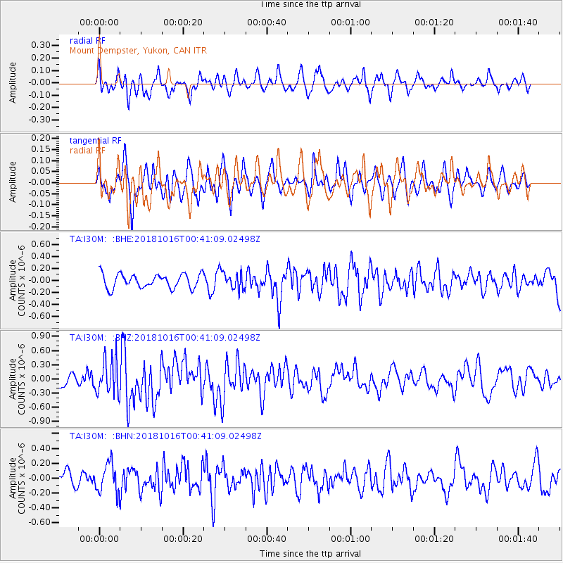
I30M Mount Dempster, Yukon, CAN - Earthquake Result Viewer
*The percent match for this event was below the threshold and hence no stack was calculated.
| Earthquake location: |
Southeast Of Loyalty Islands |
| Earthquake latitude/longitude: |
-21.9/169.5 |
| Earthquake time(UTC): |
2018/10/16 (289) 00:28:12 GMT |
| Earthquake Depth: |
10 km |
| Earthquake Magnitude: |
6.3 Mww |
| Earthquake Catalog/Contributor: |
NEIC PDE/us |
|
| Network: |
TA USArray Transportable Network (new EarthScope stations) |
| Station: |
I30M Mount Dempster, Yukon, CAN |
| Lat/Lon: |
65.22 N/136.38 W |
| Elevation: |
1399 m |
|
| Distance: |
96.2 deg |
| Az: |
20.094 deg |
| Baz: |
229.196 deg |
| Ray Param: |
$rayparam |
*The percent match for this event was below the threshold and hence was not used in the summary stack. |
|
| Radial Match: |
56.62892 % |
| Radial Bump: |
400 |
| Transverse Match: |
44.76049 % |
| Transverse Bump: |
391 |
| SOD ConfigId: |
13570011 |
| Insert Time: |
2019-05-01 13:19:49.519 +0000 |
| GWidth: |
2.5 |
| Max Bumps: |
400 |
| Tol: |
0.001 |
|
Signal To Noise
| Channel | StoN | STA | LTA |
| TA:I30M: :BHZ:20181016T00:41:09.02498Z | 3.0369015 | 3.7712633E-7 | 1.2418128E-7 |
| TA:I30M: :BHN:20181016T00:41:09.02498Z | 1.4577585 | 2.0573756E-7 | 1.411328E-7 |
| TA:I30M: :BHE:20181016T00:41:09.02498Z | 1.2013031 | 1.3865069E-7 | 1.1541691E-7 |
| Arrivals |
| Ps | |
| PpPs | |
| PsPs/PpSs | |


