You are here: Home > Network List > TA - USArray Transportable Network (new EarthScope stations) Stations List
> Station TPFO Pinon Flats, CA, USA > Earthquake Result Viewer
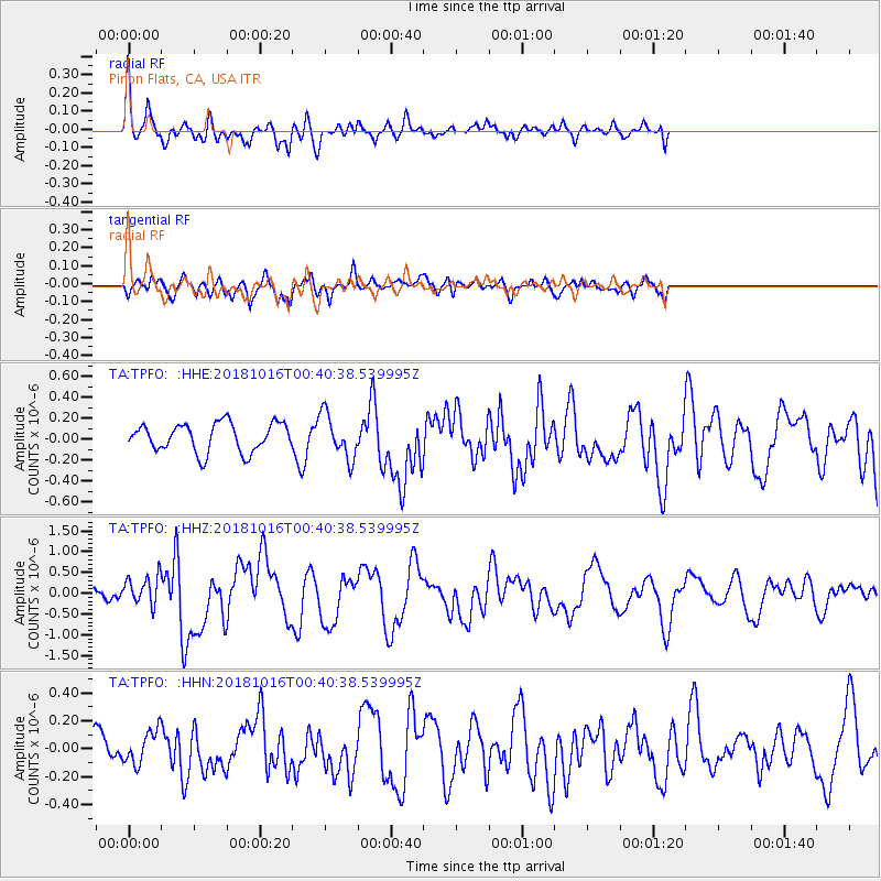
TPFO Pinon Flats, CA, USA - Earthquake Result Viewer
*The percent match for this event was below the threshold and hence no stack was calculated.
| Earthquake location: |
Southeast Of Loyalty Islands |
| Earthquake latitude/longitude: |
-21.9/169.5 |
| Earthquake time(UTC): |
2018/10/16 (289) 00:28:12 GMT |
| Earthquake Depth: |
10 km |
| Earthquake Magnitude: |
6.3 Mww |
| Earthquake Catalog/Contributor: |
NEIC PDE/us |
|
| Network: |
TA USArray Transportable Network (new EarthScope stations) |
| Station: |
TPFO Pinon Flats, CA, USA |
| Lat/Lon: |
33.61 N/116.45 W |
| Elevation: |
1275 m |
|
| Distance: |
89.5 deg |
| Az: |
53.374 deg |
| Baz: |
243.232 deg |
| Ray Param: |
$rayparam |
*The percent match for this event was below the threshold and hence was not used in the summary stack. |
|
| Radial Match: |
77.98965 % |
| Radial Bump: |
400 |
| Transverse Match: |
72.71664 % |
| Transverse Bump: |
400 |
| SOD ConfigId: |
13570011 |
| Insert Time: |
2019-05-01 13:20:33.264 +0000 |
| GWidth: |
2.5 |
| Max Bumps: |
400 |
| Tol: |
0.001 |
|
Signal To Noise
| Channel | StoN | STA | LTA |
| TA:TPFO: :HHZ:20181016T00:40:38.539995Z | 2.4127812 | 3.5346483E-7 | 1.4649684E-7 |
| TA:TPFO: :HHN:20181016T00:40:38.539995Z | 0.71639127 | 1.17538846E-7 | 1.6407074E-7 |
| TA:TPFO: :HHE:20181016T00:40:38.539995Z | 1.5672303 | 2.1240737E-7 | 1.3553041E-7 |
| Arrivals |
| Ps | |
| PpPs | |
| PsPs/PpSs | |


