You are here: Home > Network List > UW - Pacific Northwest Regional Seismic Network Stations List
> Station FISH Seaside, OR, USA > Earthquake Result Viewer
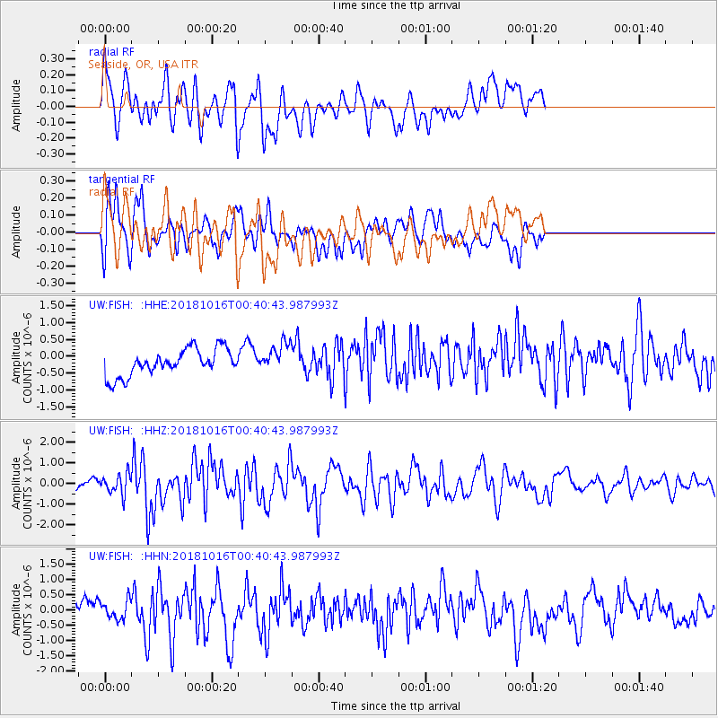
FISH Seaside, OR, USA - Earthquake Result Viewer
*The percent match for this event was below the threshold and hence no stack was calculated.
| Earthquake location: |
Southeast Of Loyalty Islands |
| Earthquake latitude/longitude: |
-21.9/169.5 |
| Earthquake time(UTC): |
2018/10/16 (289) 00:28:12 GMT |
| Earthquake Depth: |
10 km |
| Earthquake Magnitude: |
6.3 Mww |
| Earthquake Catalog/Contributor: |
NEIC PDE/us |
|
| Network: |
UW Pacific Northwest Regional Seismic Network |
| Station: |
FISH Seaside, OR, USA |
| Lat/Lon: |
45.93 N/123.56 W |
| Elevation: |
325 m |
|
| Distance: |
90.7 deg |
| Az: |
39.966 deg |
| Baz: |
238.705 deg |
| Ray Param: |
$rayparam |
*The percent match for this event was below the threshold and hence was not used in the summary stack. |
|
| Radial Match: |
69.49235 % |
| Radial Bump: |
400 |
| Transverse Match: |
63.182117 % |
| Transverse Bump: |
400 |
| SOD ConfigId: |
13570011 |
| Insert Time: |
2019-05-01 13:21:02.114 +0000 |
| GWidth: |
2.5 |
| Max Bumps: |
400 |
| Tol: |
0.001 |
|
Signal To Noise
| Channel | StoN | STA | LTA |
| UW:FISH: :HHZ:20181016T00:40:43.987993Z | 2.2433903 | 4.866882E-7 | 2.1694315E-7 |
| UW:FISH: :HHN:20181016T00:40:43.987993Z | 0.9804766 | 3.0577752E-7 | 3.1186622E-7 |
| UW:FISH: :HHE:20181016T00:40:43.987993Z | 1.0970924 | 4.2898785E-7 | 3.9102255E-7 |
| Arrivals |
| Ps | |
| PpPs | |
| PsPs/PpSs | |


