You are here: Home > Network List > UW - Pacific Northwest Regional Seismic Network Stations List
> Station LCCR Mulino, OR, USA > Earthquake Result Viewer
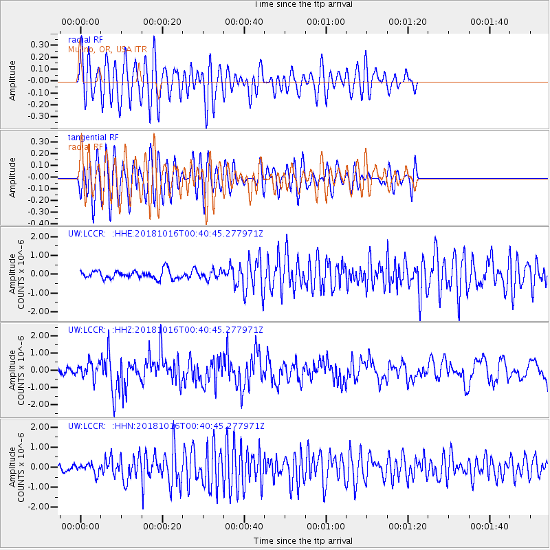
LCCR Mulino, OR, USA - Earthquake Result Viewer
*The percent match for this event was below the threshold and hence no stack was calculated.
| Earthquake location: |
Southeast Of Loyalty Islands |
| Earthquake latitude/longitude: |
-21.9/169.5 |
| Earthquake time(UTC): |
2018/10/16 (289) 00:28:12 GMT |
| Earthquake Depth: |
10 km |
| Earthquake Magnitude: |
6.3 Mww |
| Earthquake Catalog/Contributor: |
NEIC PDE/us |
|
| Network: |
UW Pacific Northwest Regional Seismic Network |
| Station: |
LCCR Mulino, OR, USA |
| Lat/Lon: |
45.21 N/122.48 W |
| Elevation: |
273 m |
|
| Distance: |
91.0 deg |
| Az: |
40.978 deg |
| Baz: |
239.459 deg |
| Ray Param: |
$rayparam |
*The percent match for this event was below the threshold and hence was not used in the summary stack. |
|
| Radial Match: |
74.027115 % |
| Radial Bump: |
400 |
| Transverse Match: |
64.90228 % |
| Transverse Bump: |
400 |
| SOD ConfigId: |
13570011 |
| Insert Time: |
2019-05-01 13:21:06.799 +0000 |
| GWidth: |
2.5 |
| Max Bumps: |
400 |
| Tol: |
0.001 |
|
Signal To Noise
| Channel | StoN | STA | LTA |
| UW:LCCR: :HHZ:20181016T00:40:45.277971Z | 3.015198 | 4.5233077E-7 | 1.5001694E-7 |
| UW:LCCR: :HHN:20181016T00:40:45.277971Z | 1.0749499 | 2.498258E-7 | 2.3240693E-7 |
| UW:LCCR: :HHE:20181016T00:40:45.277971Z | 1.0134882 | 2.1813904E-7 | 2.1523589E-7 |
| Arrivals |
| Ps | |
| PpPs | |
| PsPs/PpSs | |


