BAR Barrett Dam, California, USA - Earthquake Result Viewer
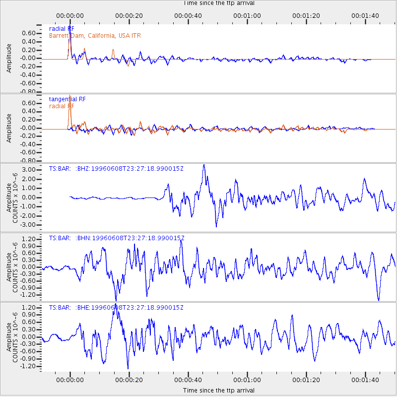
Earthquake location: Andreanof Islands, Aleutian Is.
Earthquake latitude/longitude: 51.5/-178.1
Earthquake time(UTC): 1996/06/08 (160) 23:19:15 GMT
Earthquake Depth: 33 km
Earthquake Magnitude: 5.9 MB, 6.3 MS, 6.5 UNKNOWN, 6.1 MS
Earthquake Catalog/Contributor: WHDF/NEIC
Network: TS TERRAscope (Southern California Seismic Network)
Station: BAR Barrett Dam, California, USA
Lat/Lon: 32.68 N/116.67 W
Elevation: 548 m
Distance: 47.8 deg
Az: 88.341 deg
Baz: 312.181 deg
Ray Param: 0.06968036
Estimated Moho Depth: 12.5 km
Estimated Crust Vp/Vs: 1.69
Assumed Crust Vp: 6.264 km/s
Estimated Crust Vs: 3.717 km/s
Estimated Crust Poisson's Ratio: 0.23
Radial Match: 93.13465 %
Radial Bump: 400
Transverse Match: 76.713875 %
Transverse Bump: 400
SOD ConfigId: 6273
Insert Time: 2010-02-26 13:59:00.831 +0000
GWidth: 2.5
Max Bumps: 400
Tol: 0.001

Signal To Noise

ChannelStoNSTALTA
TS:BAR: :BHN:19960608T23:27:18.990015Z3.6741322.16338E-75.8881383E-8
TS:BAR: :BHE:19960608T23:27:18.990015Z2.684822.504925E-79.3299555E-8
TS:BAR: :BHZ:19960608T23:27:18.990015Z9.2895356.446677E-76.93972E-8
Arrivals
Ps1.5 SECOND
PpPs5.0 SECOND
PsPs/PpSs6.5 SECOND