You are here: Home > Network List > TA - USArray Transportable Network (new EarthScope stations) Stations List
> Station B18K Kokolik River, AK, USA > Earthquake Result Viewer
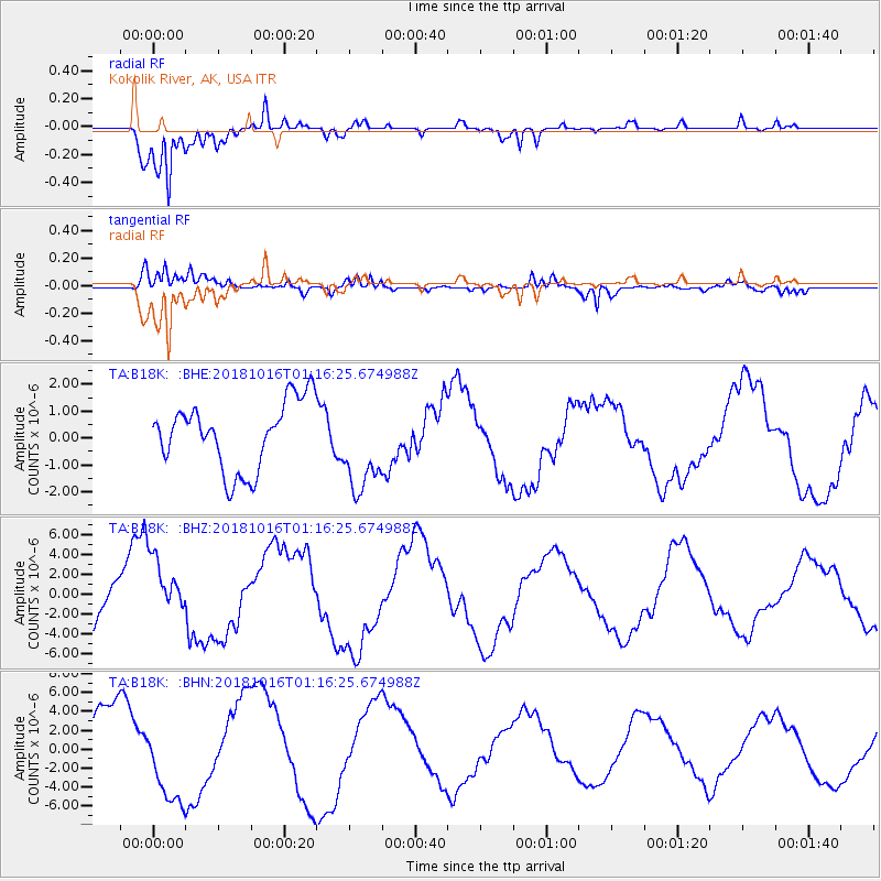
B18K Kokolik River, AK, USA - Earthquake Result Viewer
*The percent match for this event was below the threshold and hence no stack was calculated.
| Earthquake location: |
Southeast Of Loyalty Islands |
| Earthquake latitude/longitude: |
-21.7/169.4 |
| Earthquake time(UTC): |
2018/10/16 (289) 01:03:46 GMT |
| Earthquake Depth: |
10 km |
| Earthquake Magnitude: |
6.8 Mi |
| Earthquake Catalog/Contributor: |
NEIC PDE/at |
|
| Network: |
TA USArray Transportable Network (new EarthScope stations) |
| Station: |
B18K Kokolik River, AK, USA |
| Lat/Lon: |
69.36 N/161.80 W |
| Elevation: |
222 m |
|
| Distance: |
93.1 deg |
| Az: |
9.833 deg |
| Baz: |
206.614 deg |
| Ray Param: |
$rayparam |
*The percent match for this event was below the threshold and hence was not used in the summary stack. |
|
| Radial Match: |
96.26317 % |
| Radial Bump: |
329 |
| Transverse Match: |
72.09924 % |
| Transverse Bump: |
400 |
| SOD ConfigId: |
13570011 |
| Insert Time: |
2019-05-01 13:25:44.175 +0000 |
| GWidth: |
2.5 |
| Max Bumps: |
400 |
| Tol: |
0.001 |
|
Signal To Noise
| Channel | StoN | STA | LTA |
| TA:B18K: :BHZ:20181016T01:16:25.674988Z | 0.9433331 | 2.8534644E-6 | 3.0248746E-6 |
| TA:B18K: :BHN:20181016T01:16:25.674988Z | 1.3212854 | 4.752219E-6 | 3.5966636E-6 |
| TA:B18K: :BHE:20181016T01:16:25.674988Z | 1.123541 | 1.433303E-6 | 1.2757016E-6 |
| Arrivals |
| Ps | |
| PpPs | |
| PsPs/PpSs | |


