You are here: Home > Network List > TA - USArray Transportable Network (new EarthScope stations) Stations List
> Station J25K Salcha River, AK, USA > Earthquake Result Viewer
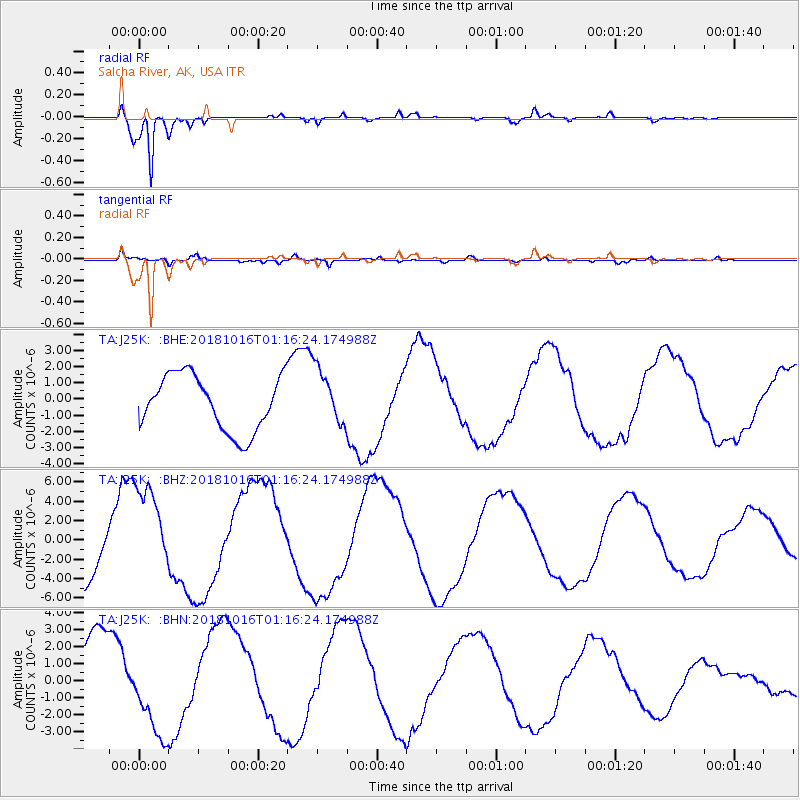
J25K Salcha River, AK, USA - Earthquake Result Viewer
*The percent match for this event was below the threshold and hence no stack was calculated.
| Earthquake location: |
Southeast Of Loyalty Islands |
| Earthquake latitude/longitude: |
-21.7/169.4 |
| Earthquake time(UTC): |
2018/10/16 (289) 01:03:46 GMT |
| Earthquake Depth: |
10 km |
| Earthquake Magnitude: |
6.8 Mi |
| Earthquake Catalog/Contributor: |
NEIC PDE/at |
|
| Network: |
TA USArray Transportable Network (new EarthScope stations) |
| Station: |
J25K Salcha River, AK, USA |
| Lat/Lon: |
64.61 N/145.37 W |
| Elevation: |
949 m |
|
| Distance: |
92.8 deg |
| Az: |
17.829 deg |
| Baz: |
221.335 deg |
| Ray Param: |
$rayparam |
*The percent match for this event was below the threshold and hence was not used in the summary stack. |
|
| Radial Match: |
98.00072 % |
| Radial Bump: |
330 |
| Transverse Match: |
60.26137 % |
| Transverse Bump: |
400 |
| SOD ConfigId: |
13570011 |
| Insert Time: |
2019-05-01 13:26:02.408 +0000 |
| GWidth: |
2.5 |
| Max Bumps: |
400 |
| Tol: |
0.001 |
|
Signal To Noise
| Channel | StoN | STA | LTA |
| TA:J25K: :BHZ:20181016T01:16:24.174988Z | 1.3524535 | 4.7624235E-6 | 3.5213216E-6 |
| TA:J25K: :BHN:20181016T01:16:24.174988Z | 1.2519847 | 2.755072E-6 | 2.2005636E-6 |
| TA:J25K: :BHE:20181016T01:16:24.174988Z | 1.3401904 | 2.6304715E-6 | 1.9627594E-6 |
| Arrivals |
| Ps | |
| PpPs | |
| PsPs/PpSs | |


