You are here: Home > Network List > TA - USArray Transportable Network (new EarthScope stations) Stations List
> Station 426A McDonald Observatory, Fort Davis, TX, USA > Earthquake Result Viewer
426A McDonald Observatory, Fort Davis, TX, USA - Earthquake Result Viewer

| Earthquake location: |
Andreanof Islands, Aleutian Is. |
| Earthquake latitude/longitude: |
51.9/-177.5 |
| Earthquake time(UTC): |
2008/05/02 (123) 01:33:37 GMT |
| Earthquake Depth: |
14 km |
| Earthquake Magnitude: |
6.3 MB, 6.8 MS, 6.6 MW, 6.6 MW |
| Earthquake Catalog/Contributor: |
WHDF/NEIC |
|
| Network: |
TA USArray Transportable Network (new EarthScope stations) |
| Station: |
426A McDonald Observatory, Fort Davis, TX, USA |
| Lat/Lon: |
30.67 N/104.03 W |
| Elevation: |
1943 m |
|
| Distance: |
56.6 deg |
| Az: |
81.55 deg |
| Baz: |
314.613 deg |
| Ray Param: |
0.06400239 |
| Estimated Moho Depth: |
40.75 km |
| Estimated Crust Vp/Vs: |
1.81 |
| Assumed Crust Vp: |
6.361 km/s |
| Estimated Crust Vs: |
3.519 km/s |
| Estimated Crust Poisson's Ratio: |
0.28 |
|
| Radial Match: |
92.79791 % |
| Radial Bump: |
400 |
| Transverse Match: |
84.55141 % |
| Transverse Bump: |
400 |
| SOD ConfigId: |
2504 |
| Insert Time: |
2010-03-06 16:58:23.984 +0000 |
| GWidth: |
2.5 |
| Max Bumps: |
400 |
| Tol: |
0.001 |
|
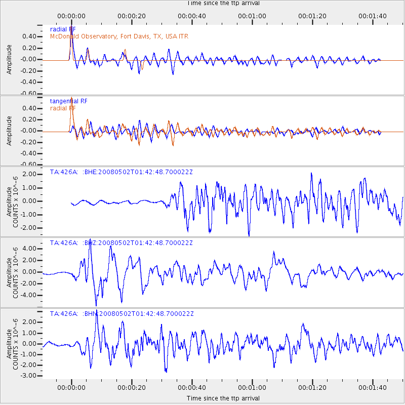
Signal To Noise
| Channel | StoN | STA | LTA |
| TA:426A: :BHZ:20080502T01:42:48.700022Z | 6.6145773 | 1.0959463E-6 | 1.6568652E-7 |
| TA:426A: :BHN:20080502T01:42:48.700022Z | 2.0869765 | 4.408719E-7 | 2.1124909E-7 |
| TA:426A: :BHE:20080502T01:42:48.700022Z | 2.898821 | 3.0546147E-7 | 1.05374376E-7 |
| Arrivals |
| Ps | 5.4 SECOND |
| PpPs | 17 SECOND |
| PsPs/PpSs | 23 SECOND |


