You are here: Home > Network List > TA - USArray Transportable Network (new EarthScope stations) Stations List
> Station N25K Chitina, Valdez-Cordova, AK, USA > Earthquake Result Viewer
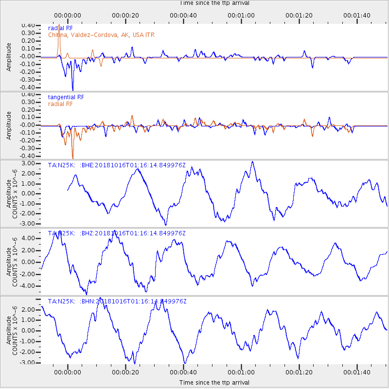
N25K Chitina, Valdez-Cordova, AK, USA - Earthquake Result Viewer
*The percent match for this event was below the threshold and hence no stack was calculated.
| Earthquake location: |
Southeast Of Loyalty Islands |
| Earthquake latitude/longitude: |
-21.7/169.4 |
| Earthquake time(UTC): |
2018/10/16 (289) 01:03:46 GMT |
| Earthquake Depth: |
10 km |
| Earthquake Magnitude: |
6.8 Mi |
| Earthquake Catalog/Contributor: |
NEIC PDE/at |
|
| Network: |
TA USArray Transportable Network (new EarthScope stations) |
| Station: |
N25K Chitina, Valdez-Cordova, AK, USA |
| Lat/Lon: |
61.61 N/144.60 W |
| Elevation: |
1087 m |
|
| Distance: |
90.8 deg |
| Az: |
20.098 deg |
| Baz: |
221.95 deg |
| Ray Param: |
$rayparam |
*The percent match for this event was below the threshold and hence was not used in the summary stack. |
|
| Radial Match: |
95.297646 % |
| Radial Bump: |
380 |
| Transverse Match: |
61.894875 % |
| Transverse Bump: |
400 |
| SOD ConfigId: |
13570011 |
| Insert Time: |
2019-05-01 13:26:13.587 +0000 |
| GWidth: |
2.5 |
| Max Bumps: |
400 |
| Tol: |
0.001 |
|
Signal To Noise
| Channel | StoN | STA | LTA |
| TA:N25K: :BHZ:20181016T01:16:14.849976Z | 1.2057291 | 2.262276E-6 | 1.8762721E-6 |
| TA:N25K: :BHN:20181016T01:16:14.849976Z | 1.9856739 | 2.2516735E-6 | 1.1339594E-6 |
| TA:N25K: :BHE:20181016T01:16:14.849976Z | 1.6495795 | 2.1055787E-6 | 1.2764336E-6 |
| Arrivals |
| Ps | |
| PpPs | |
| PsPs/PpSs | |


