You are here: Home > Network List > TA - USArray Transportable Network (new EarthScope stations) Stations List
> Station 426A McDonald Observatory, Fort Davis, TX, USA > Earthquake Result Viewer
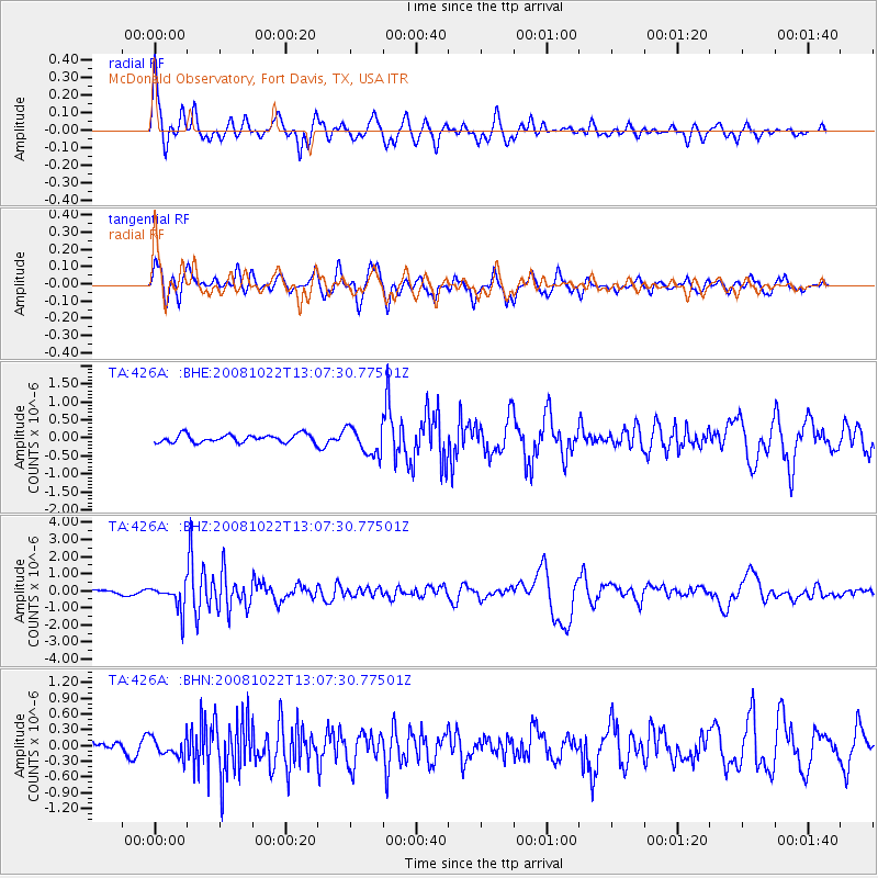
426A McDonald Observatory, Fort Davis, TX, USA - Earthquake Result Viewer
*The percent match for this event was below the threshold and hence no stack was calculated.
| Earthquake location: |
Tonga Islands |
| Earthquake latitude/longitude: |
-18.4/-175.4 |
| Earthquake time(UTC): |
2008/10/22 (296) 12:55:57 GMT |
| Earthquake Depth: |
233 km |
| Earthquake Magnitude: |
5.9 MB, 6.4 MW, 6.3 MW |
| Earthquake Catalog/Contributor: |
WHDF/NEIC |
|
| Network: |
TA USArray Transportable Network (new EarthScope stations) |
| Station: |
426A McDonald Observatory, Fort Davis, TX, USA |
| Lat/Lon: |
30.67 N/104.03 W |
| Elevation: |
1943 m |
|
| Distance: |
84.1 deg |
| Az: |
55.143 deg |
| Baz: |
244.716 deg |
| Ray Param: |
$rayparam |
*The percent match for this event was below the threshold and hence was not used in the summary stack. |
|
| Radial Match: |
53.908974 % |
| Radial Bump: |
331 |
| Transverse Match: |
56.457027 % |
| Transverse Bump: |
400 |
| SOD ConfigId: |
2556 |
| Insert Time: |
2010-03-06 16:59:04.820 +0000 |
| GWidth: |
2.5 |
| Max Bumps: |
400 |
| Tol: |
0.001 |
|
Signal To Noise
| Channel | StoN | STA | LTA |
| TA:426A: :BHZ:20081022T13:07:30.77501Z | 3.357724 | 7.472216E-7 | 2.225381E-7 |
| TA:426A: :BHN:20081022T13:07:30.77501Z | 0.91500485 | 1.7934667E-7 | 1.9600624E-7 |
| TA:426A: :BHE:20081022T13:07:30.77501Z | 3.446763 | 3.8713196E-7 | 1.12317544E-7 |
| Arrivals |
| Ps | |
| PpPs | |
| PsPs/PpSs | |


