You are here: Home > Network List > CI - Caltech Regional Seismic Network Stations List
> Station MPM Manuel Prospect Mine, California, USA > Earthquake Result Viewer
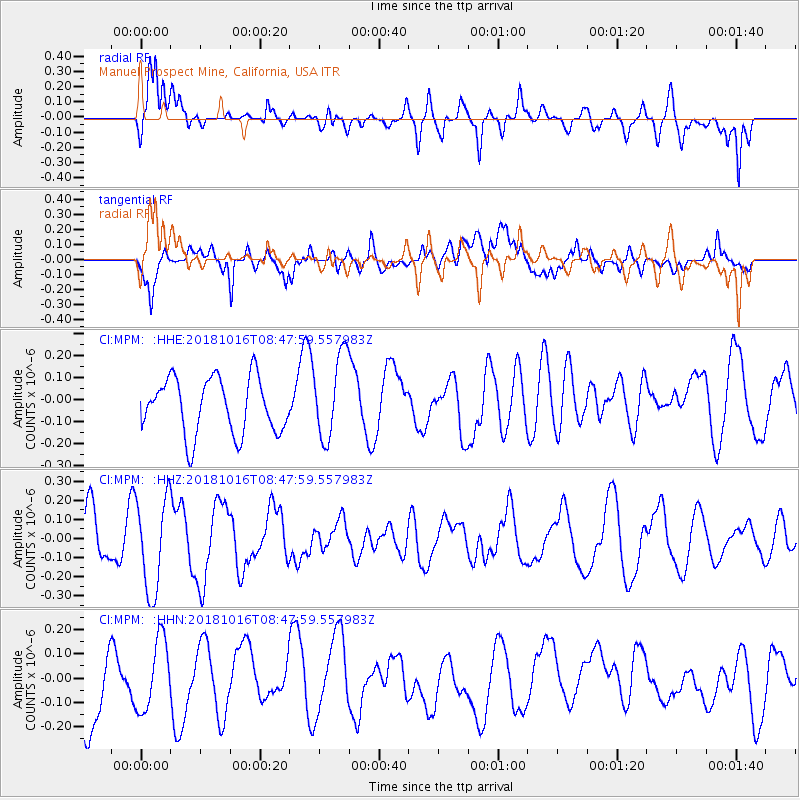
MPM Manuel Prospect Mine, California, USA - Earthquake Result Viewer
*The percent match for this event was below the threshold and hence no stack was calculated.
| Earthquake location: |
Central Mid-Atlantic Ridge |
| Earthquake latitude/longitude: |
0.9/-28.2 |
| Earthquake time(UTC): |
2018/10/16 (289) 08:35:37 GMT |
| Earthquake Depth: |
10 km |
| Earthquake Magnitude: |
5.3 mb |
| Earthquake Catalog/Contributor: |
NEIC PDE/us |
|
| Network: |
CI Caltech Regional Seismic Network |
| Station: |
MPM Manuel Prospect Mine, California, USA |
| Lat/Lon: |
36.06 N/117.49 W |
| Elevation: |
185 m |
|
| Distance: |
88.8 deg |
| Az: |
305.866 deg |
| Baz: |
89.682 deg |
| Ray Param: |
$rayparam |
*The percent match for this event was below the threshold and hence was not used in the summary stack. |
|
| Radial Match: |
60.807518 % |
| Radial Bump: |
400 |
| Transverse Match: |
51.777527 % |
| Transverse Bump: |
400 |
| SOD ConfigId: |
13570011 |
| Insert Time: |
2019-05-01 13:39:29.795 +0000 |
| GWidth: |
2.5 |
| Max Bumps: |
400 |
| Tol: |
0.001 |
|
Signal To Noise
| Channel | StoN | STA | LTA |
| CI:MPM: :HHZ:20181016T08:47:59.557983Z | 1.5620934 | 2.4436082E-7 | 1.5643162E-7 |
| CI:MPM: :HHN:20181016T08:47:59.557983Z | 1.0673981 | 1.4720715E-7 | 1.3791212E-7 |
| CI:MPM: :HHE:20181016T08:47:59.557983Z | 1.5157719 | 1.9102724E-7 | 1.2602638E-7 |
| Arrivals |
| Ps | |
| PpPs | |
| PsPs/PpSs | |


