You are here: Home > Network List > NE - New England Seismic Network Stations List
> Station EMMW Machias, ME, USA > Earthquake Result Viewer
EMMW Machias, ME, USA - Earthquake Result Viewer
*The percent match for this event was below the threshold and hence no stack was calculated.
| Earthquake location: |
Jujuy Province, Argentina |
| Earthquake latitude/longitude: |
-22.4/-66.0 |
| Earthquake time(UTC): |
2016/08/04 (217) 14:15:11 GMT |
| Earthquake Depth: |
258 km |
| Earthquake Magnitude: |
6.0 MO |
| Earthquake Catalog/Contributor: |
NEIC PDE/NEIC ALERT |
|
| Network: |
NE New England Seismic Network |
| Station: |
EMMW Machias, ME, USA |
| Lat/Lon: |
44.71 N/67.46 W |
| Elevation: |
35 m |
|
| Distance: |
66.8 deg |
| Az: |
358.865 deg |
| Baz: |
178.526 deg |
| Ray Param: |
$rayparam |
*The percent match for this event was below the threshold and hence was not used in the summary stack. |
|
| Radial Match: |
70.092224 % |
| Radial Bump: |
400 |
| Transverse Match: |
35.229977 % |
| Transverse Bump: |
400 |
| SOD ConfigId: |
1634031 |
| Insert Time: |
2016-08-18 14:18:31.211 +0000 |
| GWidth: |
2.5 |
| Max Bumps: |
400 |
| Tol: |
0.001 |
|
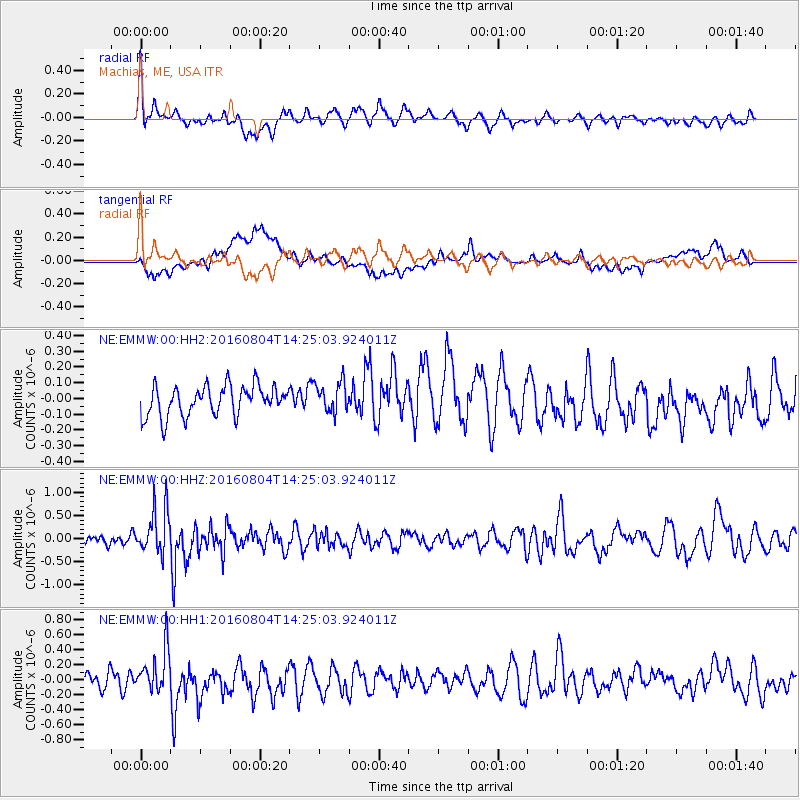
Signal To Noise
| Channel | StoN | STA | LTA |
| NE:EMMW:00:HHZ:20160804T14:25:03.924011Z | 2.3571906 | 4.856513E-7 | 2.0602971E-7 |
| NE:EMMW:00:HH1:20160804T14:25:03.924011Z | 3.0464175 | 2.896771E-7 | 9.5087785E-8 |
| NE:EMMW:00:HH2:20160804T14:25:03.924011Z | 1.0023037 | 9.600039E-8 | 9.577975E-8 |
| Arrivals |
| Ps | |
| PpPs | |
| PsPs/PpSs | |


