You are here: Home > Network List > TA - USArray Transportable Network (new EarthScope stations) Stations List
> Station T25A Trinidad, CO, USA > Earthquake Result Viewer
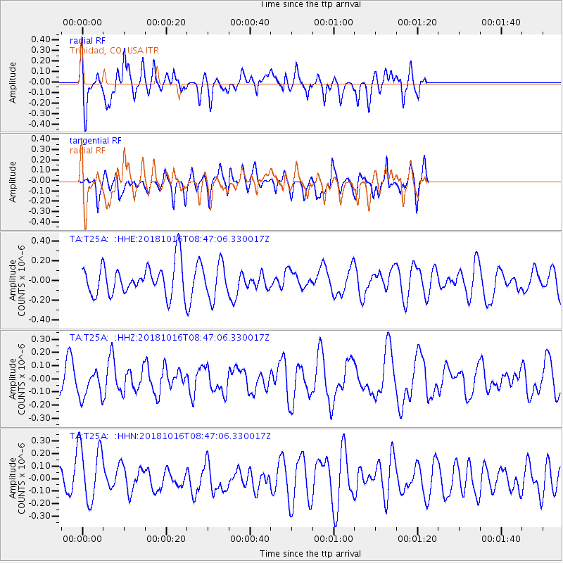
T25A Trinidad, CO, USA - Earthquake Result Viewer
*The percent match for this event was below the threshold and hence no stack was calculated.
| Earthquake location: |
Central Mid-Atlantic Ridge |
| Earthquake latitude/longitude: |
0.9/-28.2 |
| Earthquake time(UTC): |
2018/10/16 (289) 08:35:37 GMT |
| Earthquake Depth: |
10 km |
| Earthquake Magnitude: |
5.3 mb |
| Earthquake Catalog/Contributor: |
NEIC PDE/us |
|
| Network: |
TA USArray Transportable Network (new EarthScope stations) |
| Station: |
T25A Trinidad, CO, USA |
| Lat/Lon: |
37.14 N/104.41 W |
| Elevation: |
2017 m |
|
| Distance: |
78.4 deg |
| Az: |
307.619 deg |
| Baz: |
97.663 deg |
| Ray Param: |
$rayparam |
*The percent match for this event was below the threshold and hence was not used in the summary stack. |
|
| Radial Match: |
43.655617 % |
| Radial Bump: |
400 |
| Transverse Match: |
52.84128 % |
| Transverse Bump: |
400 |
| SOD ConfigId: |
13570011 |
| Insert Time: |
2019-05-01 13:44:11.162 +0000 |
| GWidth: |
2.5 |
| Max Bumps: |
400 |
| Tol: |
0.001 |
|
Signal To Noise
| Channel | StoN | STA | LTA |
| TA:T25A: :HHZ:20181016T08:47:06.330017Z | 1.0016218 | 1.0620138E-7 | 1.0602942E-7 |
| TA:T25A: :HHN:20181016T08:47:06.330017Z | 2.7807531 | 2.4072972E-7 | 8.656997E-8 |
| TA:T25A: :HHE:20181016T08:47:06.330017Z | 1.1250385 | 1.7630326E-7 | 1.5670864E-7 |
| Arrivals |
| Ps | |
| PpPs | |
| PsPs/PpSs | |


