You are here: Home > Network List > TA - USArray Transportable Network (new EarthScope stations) Stations List
> Station A21K Barrow, AK, USA > Earthquake Result Viewer
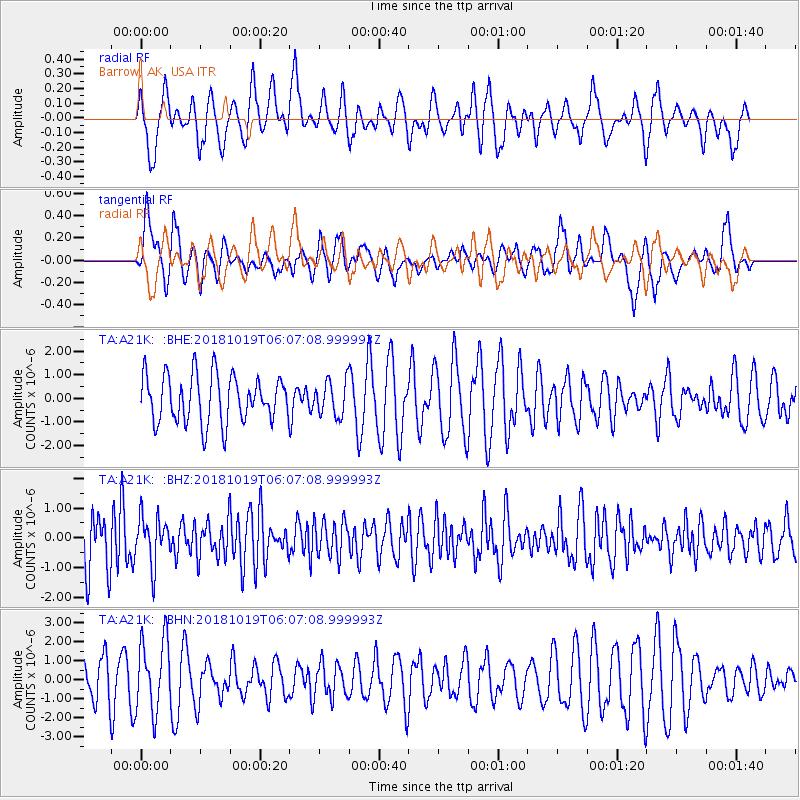
A21K Barrow, AK, USA - Earthquake Result Viewer
*The percent match for this event was below the threshold and hence no stack was calculated.
| Earthquake location: |
Near North Coast Of Irian Jaya |
| Earthquake latitude/longitude: |
-2.8/139.1 |
| Earthquake time(UTC): |
2018/10/19 (292) 05:55:12 GMT |
| Earthquake Depth: |
58 km |
| Earthquake Magnitude: |
5.5 Mww |
| Earthquake Catalog/Contributor: |
NEIC PDE/us |
|
| Network: |
TA USArray Transportable Network (new EarthScope stations) |
| Station: |
A21K Barrow, AK, USA |
| Lat/Lon: |
71.32 N/156.62 W |
| Elevation: |
577 m |
|
| Distance: |
84.6 deg |
| Az: |
16.948 deg |
| Baz: |
244.648 deg |
| Ray Param: |
$rayparam |
*The percent match for this event was below the threshold and hence was not used in the summary stack. |
|
| Radial Match: |
58.36054 % |
| Radial Bump: |
400 |
| Transverse Match: |
53.399975 % |
| Transverse Bump: |
400 |
| SOD ConfigId: |
13570011 |
| Insert Time: |
2019-05-01 13:54:44.989 +0000 |
| GWidth: |
2.5 |
| Max Bumps: |
400 |
| Tol: |
0.001 |
|
Signal To Noise
| Channel | StoN | STA | LTA |
| TA:A21K: :BHZ:20181019T06:07:08.999993Z | 1.0907303 | 7.964813E-7 | 7.302275E-7 |
| TA:A21K: :BHN:20181019T06:07:08.999993Z | 2.336598 | 1.9061116E-6 | 8.1576366E-7 |
| TA:A21K: :BHE:20181019T06:07:08.999993Z | 0.73323995 | 7.361931E-7 | 1.0040276E-6 |
| Arrivals |
| Ps | |
| PpPs | |
| PsPs/PpSs | |


