You are here: Home > Network List > TA - USArray Transportable Network (new EarthScope stations) Stations List
> Station B22K Teshekpuk Lake, AK, USA > Earthquake Result Viewer
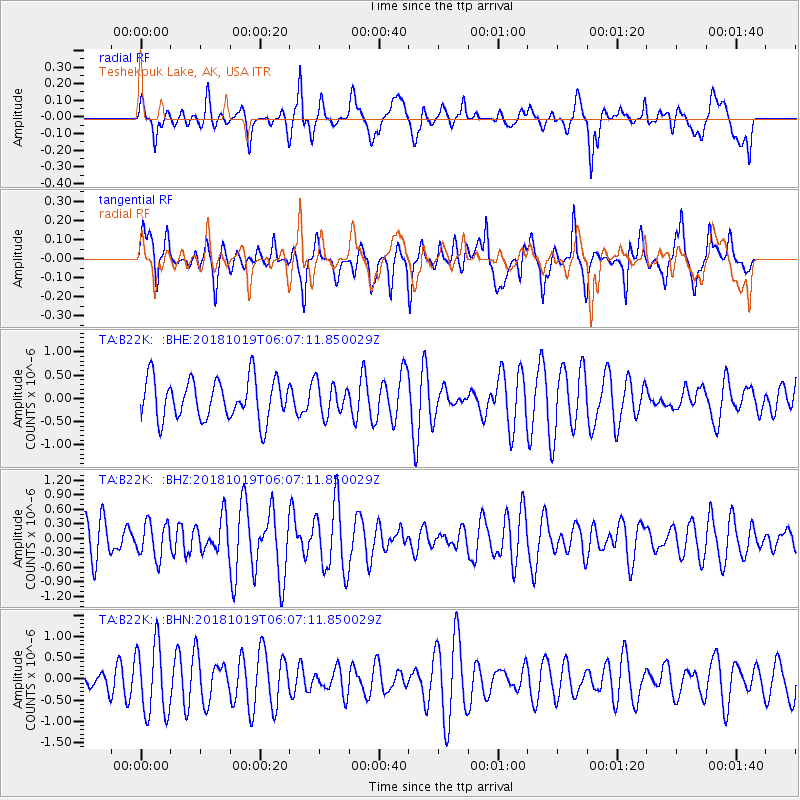
B22K Teshekpuk Lake, AK, USA - Earthquake Result Viewer
*The percent match for this event was below the threshold and hence no stack was calculated.
| Earthquake location: |
Near North Coast Of Irian Jaya |
| Earthquake latitude/longitude: |
-2.8/139.1 |
| Earthquake time(UTC): |
2018/10/19 (292) 05:55:12 GMT |
| Earthquake Depth: |
58 km |
| Earthquake Magnitude: |
5.5 Mww |
| Earthquake Catalog/Contributor: |
NEIC PDE/us |
|
| Network: |
TA USArray Transportable Network (new EarthScope stations) |
| Station: |
B22K Teshekpuk Lake, AK, USA |
| Lat/Lon: |
70.34 N/153.42 W |
| Elevation: |
50 m |
|
| Distance: |
85.2 deg |
| Az: |
18.282 deg |
| Baz: |
247.785 deg |
| Ray Param: |
$rayparam |
*The percent match for this event was below the threshold and hence was not used in the summary stack. |
|
| Radial Match: |
53.475937 % |
| Radial Bump: |
400 |
| Transverse Match: |
47.06937 % |
| Transverse Bump: |
400 |
| SOD ConfigId: |
13570011 |
| Insert Time: |
2019-05-01 13:54:45.605 +0000 |
| GWidth: |
2.5 |
| Max Bumps: |
400 |
| Tol: |
0.001 |
|
Signal To Noise
| Channel | StoN | STA | LTA |
| TA:B22K: :BHZ:20181019T06:07:11.850029Z | 0.82517 | 3.592797E-7 | 4.3540086E-7 |
| TA:B22K: :BHN:20181019T06:07:11.850029Z | 3.3883095 | 8.2844485E-7 | 2.4450094E-7 |
| TA:B22K: :BHE:20181019T06:07:11.850029Z | 0.7895427 | 3.434015E-7 | 4.349372E-7 |
| Arrivals |
| Ps | |
| PpPs | |
| PsPs/PpSs | |


