You are here: Home > Network List > TA - USArray Transportable Network (new EarthScope stations) Stations List
> Station I30M Mount Dempster, Yukon, CAN > Earthquake Result Viewer
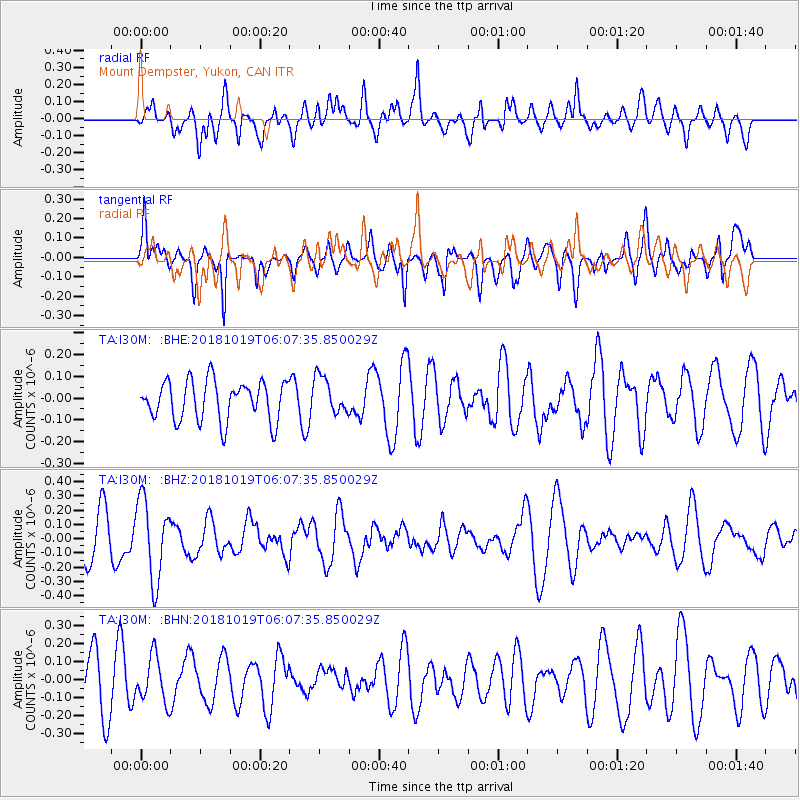
I30M Mount Dempster, Yukon, CAN - Earthquake Result Viewer
*The percent match for this event was below the threshold and hence no stack was calculated.
| Earthquake location: |
Near North Coast Of Irian Jaya |
| Earthquake latitude/longitude: |
-2.8/139.1 |
| Earthquake time(UTC): |
2018/10/19 (292) 05:55:12 GMT |
| Earthquake Depth: |
58 km |
| Earthquake Magnitude: |
5.5 Mww |
| Earthquake Catalog/Contributor: |
NEIC PDE/us |
|
| Network: |
TA USArray Transportable Network (new EarthScope stations) |
| Station: |
I30M Mount Dempster, Yukon, CAN |
| Lat/Lon: |
65.22 N/136.38 W |
| Elevation: |
1399 m |
|
| Distance: |
90.2 deg |
| Az: |
24.802 deg |
| Baz: |
263.839 deg |
| Ray Param: |
$rayparam |
*The percent match for this event was below the threshold and hence was not used in the summary stack. |
|
| Radial Match: |
61.06046 % |
| Radial Bump: |
400 |
| Transverse Match: |
49.498154 % |
| Transverse Bump: |
384 |
| SOD ConfigId: |
13570011 |
| Insert Time: |
2019-05-01 13:55:02.005 +0000 |
| GWidth: |
2.5 |
| Max Bumps: |
400 |
| Tol: |
0.001 |
|
Signal To Noise
| Channel | StoN | STA | LTA |
| TA:I30M: :BHZ:20181019T06:07:35.850029Z | 2.1629508 | 2.81462E-7 | 1.3012871E-7 |
| TA:I30M: :BHN:20181019T06:07:35.850029Z | 0.7869159 | 1.2635284E-7 | 1.6056715E-7 |
| TA:I30M: :BHE:20181019T06:07:35.850029Z | 0.9365966 | 8.57348E-8 | 9.153866E-8 |
| Arrivals |
| Ps | |
| PpPs | |
| PsPs/PpSs | |


